MyTopo
Crane Missouri US Topo Map
Couldn't load pickup availability
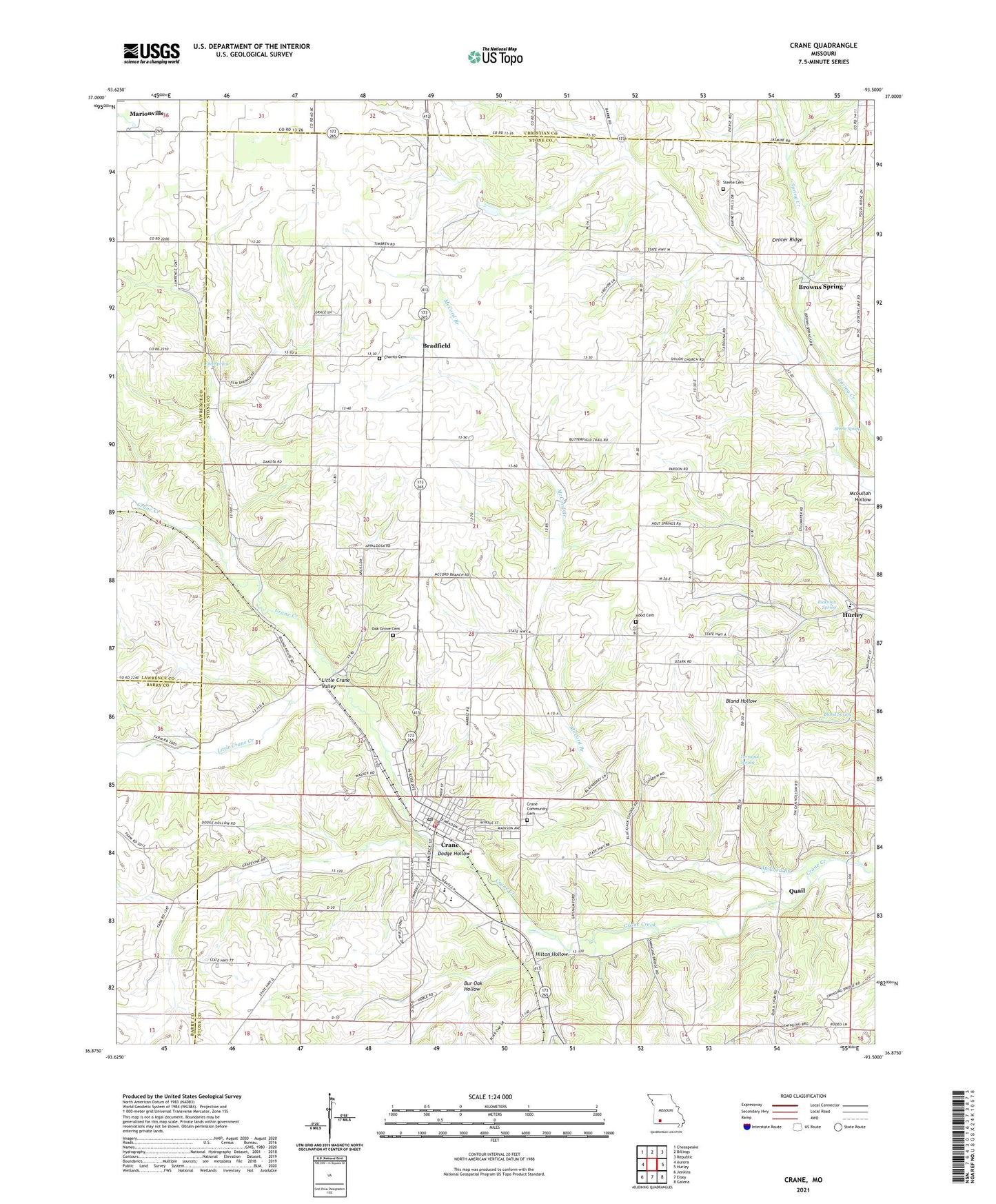
2021 topographic map quadrangle Crane in the state of Missouri. Scale: 1:24000. Based on the newly updated USGS 7.5' US Topo map series, this map is in the following counties: Stone, Lawrence, Barry, Christian. The map contains contour data, water features, and other items you are used to seeing on USGS maps, but also has updated roads and other features. This is the next generation of topographic maps. Printed on high-quality waterproof paper with UV fade-resistant inks.
Quads adjacent to this one:
West: Aurora
Northwest: Chesapeake
North: Billings
Northeast: Republic
East: Hurley
Southeast: Galena
South: Elsey
Southwest: Jenkins
Contains the following named places: Blackjack School, Bland Spring, Bradfield, Brown Springs School, Browns Spring, Bur Oak Hollow, Cedar Hill School, Center Ridge, Charity Cemetery, Charity School, City of Crane, Crane, Crane Cemetery, Crane Community Cemetery, Crane Fire and Rescue, Crane Police Department, Crane Post Office, Crane School, Crane Structure Number 1 Dam, Crane Structure Number 1 Reservoir, Dodge Hollow, Elm Spring, Hilton Hollow, Hood Cemetery, Little Crane Creek, Little Crane Valley, McCord Branch, North Stone Northeast Barry County Fire District Station 23, Oak Grove Cemetery, Oak Grove School, Pierson Church, Quail, Rickman Spring, Shiloh Church, Steele Cemetery, Steele Spring, Terrapin Spring, Township of Grant, Township of Pierce, ZIP Codes: 65633, 65705