MyTopo
Cyclone Hollow Missouri US Topo Map
Couldn't load pickup availability
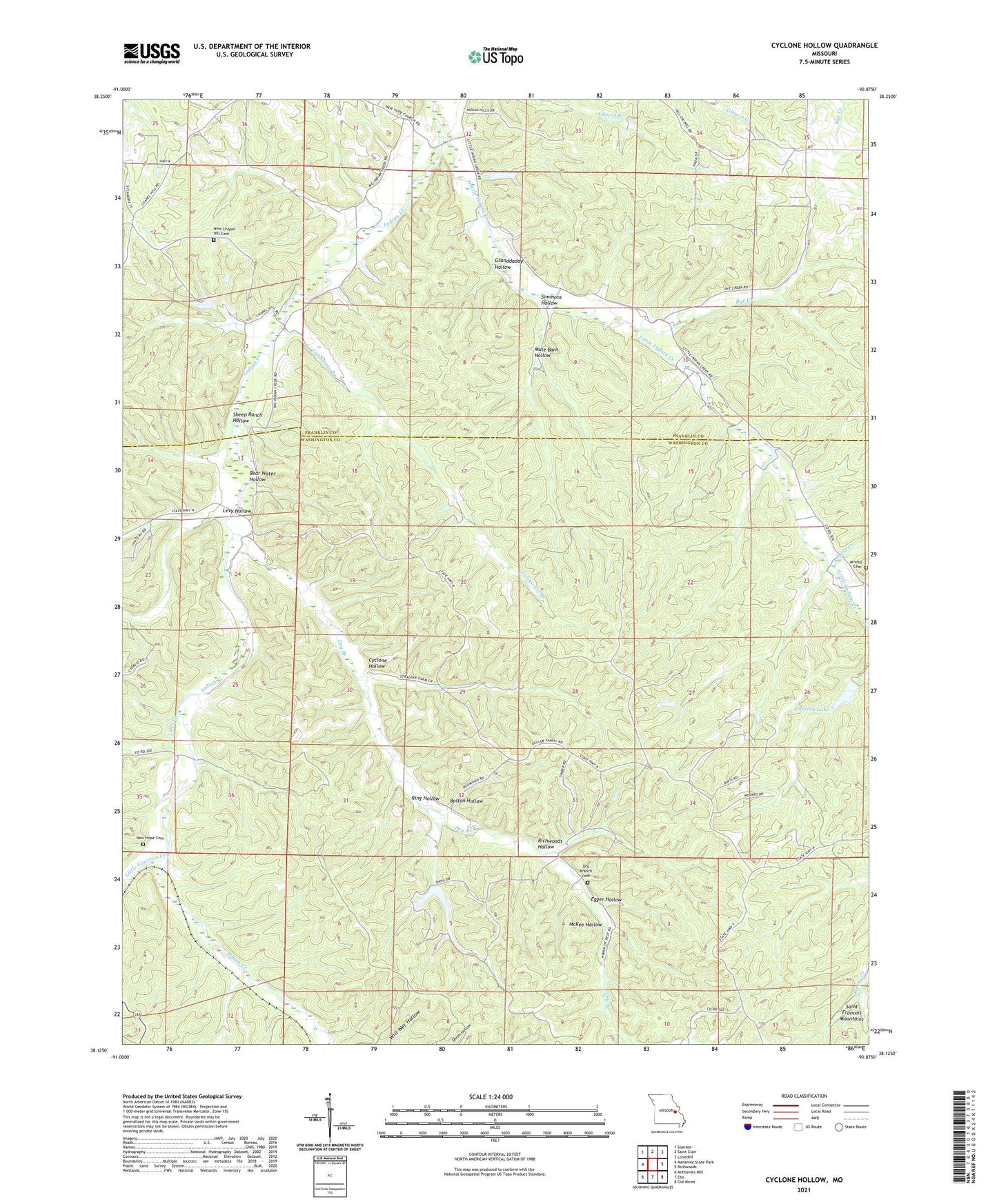
2021 topographic map quadrangle Cyclone Hollow in the state of Missouri. Scale: 1:24000. Based on the newly updated USGS 7.5' US Topo map series, this map is in the following counties: Washington, Franklin. The map contains contour data, water features, and other items you are used to seeing on USGS maps, but also has updated roads and other features. This is the next generation of topographic maps. Printed on high-quality waterproof paper with UV fade-resistant inks.
Quads adjacent to this one:
West: Meramec State Park
Northwest: Stanton
North: Saint Clair
Northeast: Lonedell
East: Richwoods
Southeast: Old Mines
South: Ebo
Southwest: Anthonies Mill
Contains the following named places: Arnold Cemetery, Arnold Creek, Artesian Lake, Artesian Lake Dam, Baha Trail Lake Dam, Bear Water Hollow, Bluff School, Bolton Hollow, California Branch, Cyclone Hollow, Cyclone School, Dry Branch, Dry Branch Cemetery, Egger Hollow, George, George Lake Dam, Granddaddy Hollow, Henson School, Huff, Hulsey School, Indian Creek School, James Bakers Sawmill, Jules Creek, Levy Hollow, Little Courtois Creek, Little Indian Creek, Maple Grove School, McKee Hollow, Mule Barn Hollow, New Chapel Hill Cemetery, New Chapel Hill Church, New Hope Cemetery, New Hope Church, Oklahoma School, Prospect Church, Richwoods Hollow, Ring Hollow, Ruhl Lake Dam, Rye Creek, Sheep Ranch Hollow, Simmons Hollow