MyTopo
Dayton Missouri US Topo Map
Couldn't load pickup availability
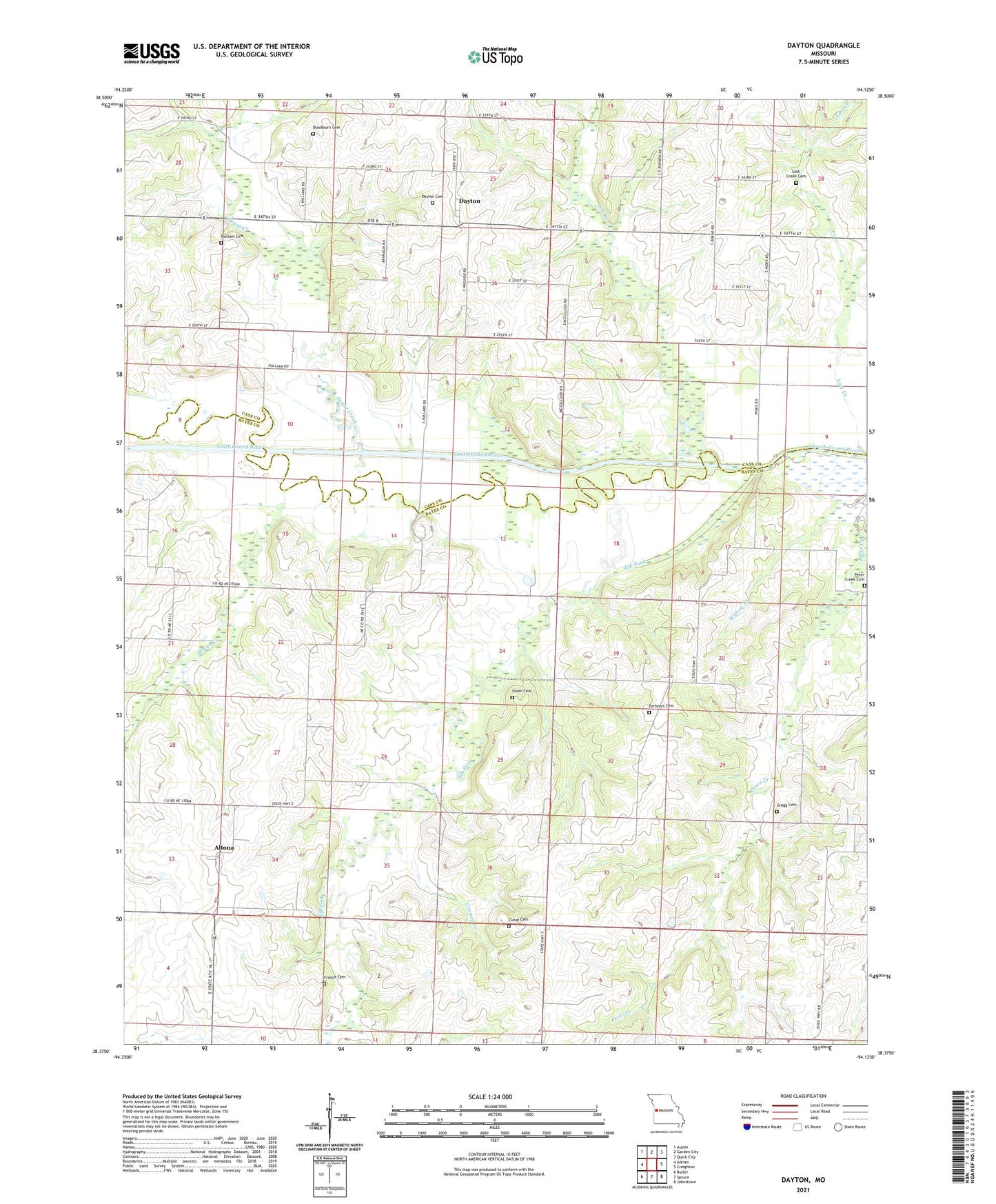
2021 topographic map quadrangle Dayton in the state of Missouri. Scale: 1:24000. Based on the newly updated USGS 7.5' US Topo map series, this map is in the following counties: Bates, Cass. The map contains contour data, water features, and other items you are used to seeing on USGS maps, but also has updated roads and other features. This is the next generation of topographic maps. Printed on high-quality waterproof paper with UV fade-resistant inks.
Quads adjacent to this one:
West: Adrian
Northwest: Austin
North: Garden City
Northeast: Quick City
East: Creighton
Southeast: Johnstown
South: Spruce
Southwest: Butler
Contains the following named places: Aaron, Aaron Post Office, Altona, Altona School, Blackburn Cemetery, Bryan School, Choctaw School, Cloud Cemetery, Cooney Creek, Crawford School, Dayton, Dayton School, Earheart Cemetery, Elk Fork, France Cemetery, Gragg Cemetery, Highland School, Leos Angus Ranch Airport, Lick Branch, Lost Creek, Lost Creek Cemetery, McKinley School, Mingo Creek, Owen Cemetery, Peter Creek, Peter Creek Cemetery, Pulliam Cemetery, Sugar Creek, Township of Grand River