MyTopo
Austin Missouri US Topo Map
Couldn't load pickup availability
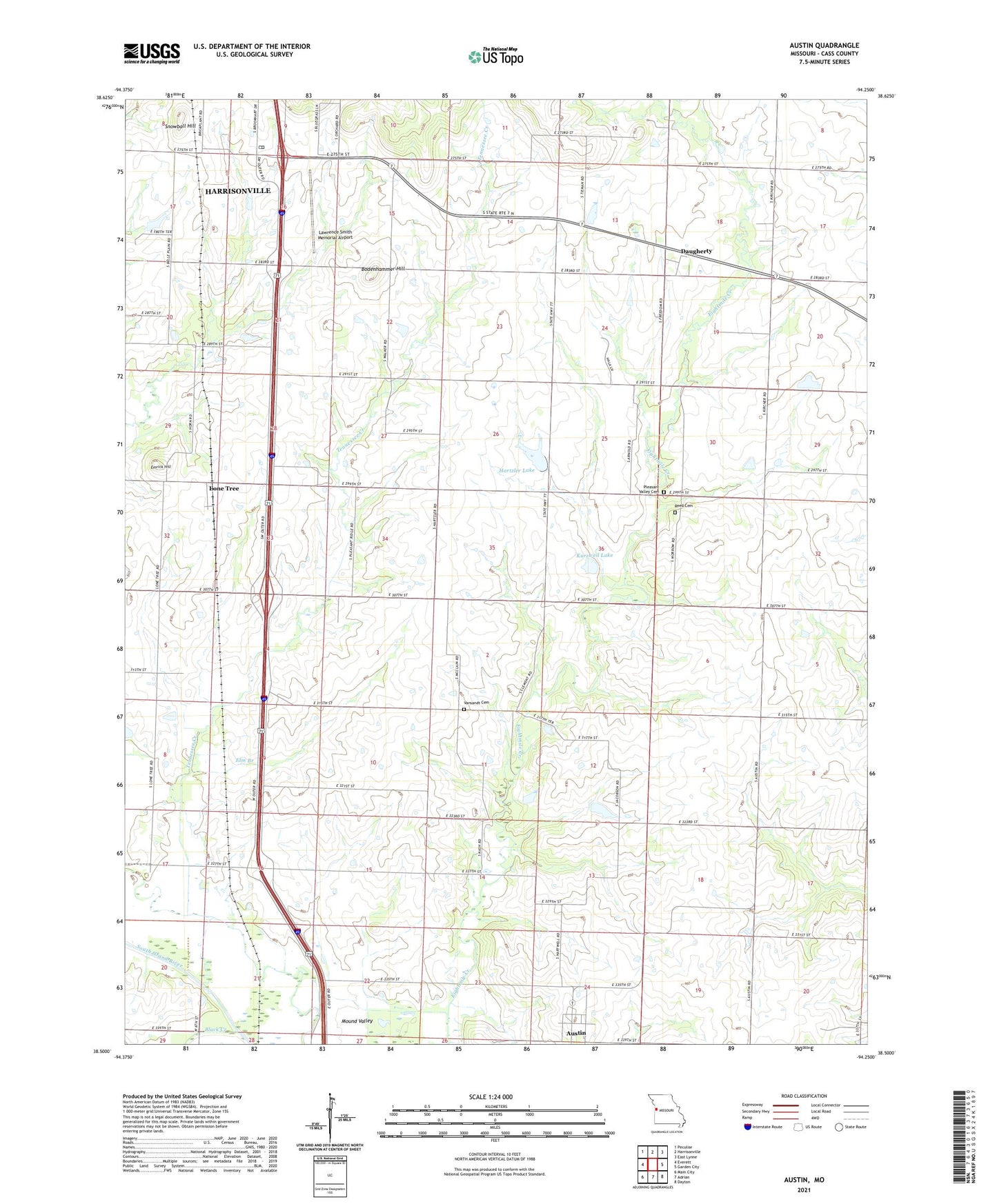
2021 topographic map quadrangle Austin in the state of Missouri. Scale: 1:24000. Based on the newly updated USGS 7.5' US Topo map series, this map is in the following counties: Cass. The map contains contour data, water features, and other items you are used to seeing on USGS maps, but also has updated roads and other features. This is the next generation of topographic maps. Printed on high-quality waterproof paper with UV fade-resistant inks.
Quads adjacent to this one:
West: Everett
Northwest: Peculiar
North: Harrisonville
Northeast: East Lynne
East: Garden City
Southeast: Dayton
South: Adrian
Southwest: Main City
This map covers the same area as the classic USGS quad with code o38094e3.
Contains the following named places: Austin, Austin School, Belle Plain School, Black Creek, Bodenhammer Hill, Cook Lake Dam, Daugherty, Eightmile School, Elm Branch, Elm Branch School, Emrick Hill, Harrisonville South Wastewater Treatment Plant, Hartzler Lake, Hartzler Lake Dam, Houston School, Hutchison School, J A Tobin Construction Company Dam, J A Tobin Construction Company Lake, Kurzweil Lake, Kurzweil Lake Dam, Lawrence Smith Memorial Airport, Lone Tree, Lone Tree School, Mound Valley, Mullin School, Pleasant Ridge Church, Pleasant Ridge School, Pleasant Valley Cemetery, Reed Cemetery, Rural Home, School Number 36, Snowball Hill, Tennessee Creek, Township of Austin, Township of Grand River, Union Hall School, Vansandt Cemetery, ZIP Code: 64701