MyTopo
Edina Missouri US Topo Map
Couldn't load pickup availability
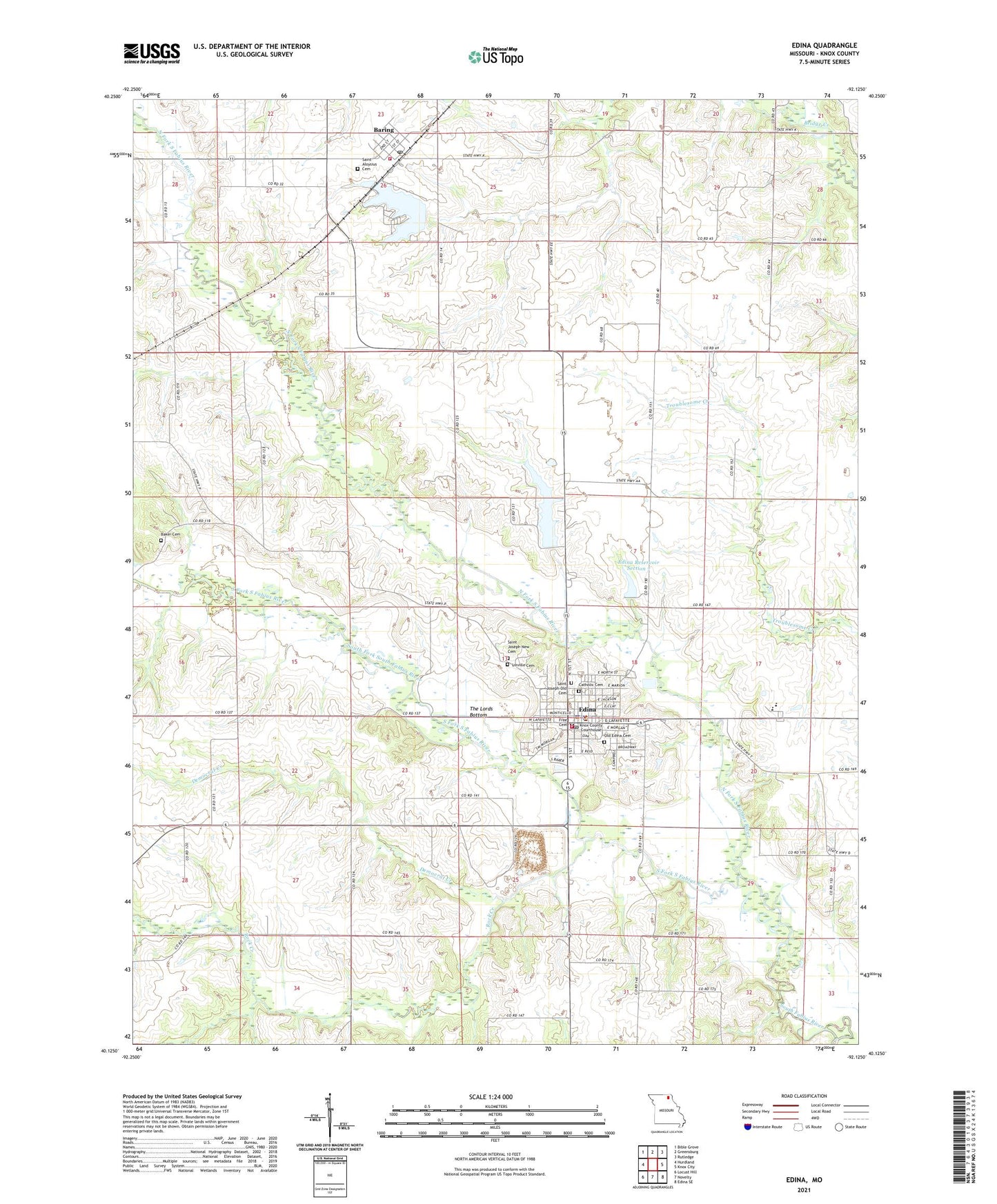
2021 topographic map quadrangle Edina in the state of Missouri. Scale: 1:24000. Based on the newly updated USGS 7.5' US Topo map series, this map is in the following counties: Knox. The map contains contour data, water features, and other items you are used to seeing on USGS maps, but also has updated roads and other features. This is the next generation of topographic maps. Printed on high-quality waterproof paper with UV fade-resistant inks.
Quads adjacent to this one:
West: Hurdland
Northwest: Bible Grove
North: Greensburg
Northeast: Rutledge
East: Knox City
Southeast: Edina SE
South: Novelty
Southwest: Locust Hill
Contains the following named places: Baker Cemetery, Baring, Baring Country Club Dam, Baring Country Club Lake, Baring Fire Department, Baring Post Office, Beal School, Bowen Brothers Mill, Catholic Cemetery, City of Baring, City of Edina, Clancy School, Democrat Creek, Edina, Edina Fire Department, Edina Golf Club, Edina Police Department, Edina Post Office, Edina Reservoir, Edina Reservoir Section 12 Dam, Edina Reservoir Section 7, Edina Reservoir Section 7 Dam, Free Cemetery, Knox County, Knox County High School, Knox County Sheriff's Office, Linville Cemetery, McCauley School, Milltown, North Fork South Fabius River, Old Edina Cemetery, Pleasant Valley School, Rock Creek, Saint Aloysius Cemetery, Saint Joseph Church, Saint Joseph New Cemetery, Saint Joseph Old Cemetery, Saint Josephs Convent, South Fork South Fabius River, The Lords Bottom, Township of Center, ZIP Code: 63537