MyTopo
Fairfax Missouri US Topo Map
Couldn't load pickup availability
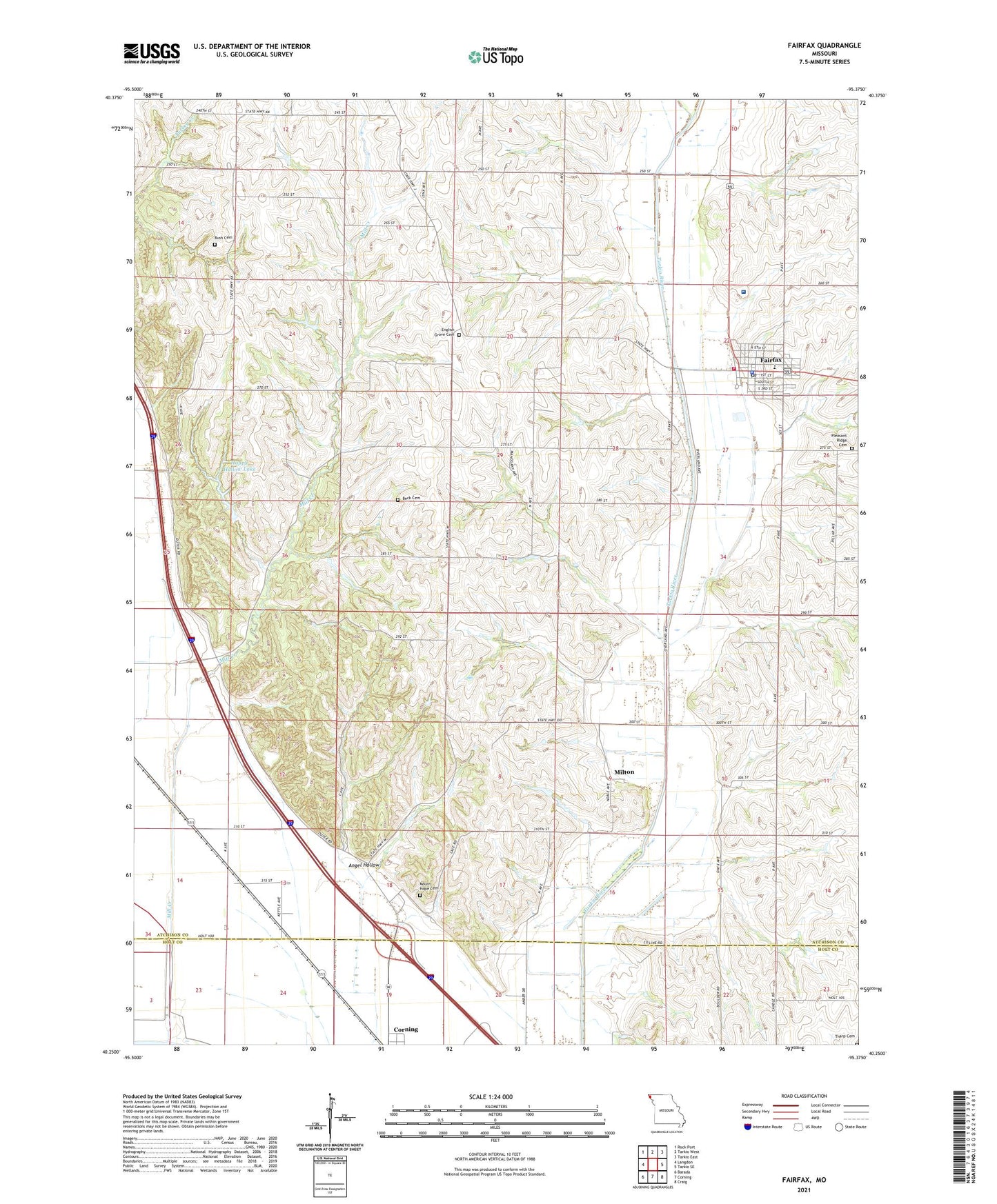
2021 topographic map quadrangle Fairfax in the state of Missouri. Scale: 1:24000. Based on the newly updated USGS 7.5' US Topo map series, this map is in the following counties: Atchison, Holt. The map contains contour data, water features, and other items you are used to seeing on USGS maps, but also has updated roads and other features. This is the next generation of topographic maps. Printed on high-quality waterproof paper with UV fade-resistant inks.
Quads adjacent to this one:
West: Langdon
Northwest: Rock Port
North: Tarkio West
Northeast: Tarkio East
East: Tarkio SE
Southeast: Craig
South: Corning
Southwest: Barada
Contains the following named places: Angel Hollow, Angel School, Beck Cemetery, Bush Cemetery, City of Fairfax, Community Hospital - Fairfax, Corning Cemetery, Cow Branch, English Grove Cemetery, English Grove Church, Fairfax, Fairfax Elementary School, Fairfax High School, Fairfax Police Department, Fairfax Post Office, Fairfax Volunteer Fire Department, Graves Lake Dam, Happy Hollow Lake, Irish Grove School, Lowell Pierce Dam, McCoy-Waits Lake Dam, Mill Creek, Milton, Milton School, Mount Hope Cemetery, Mount Pleasant School, Pleasant Ridge Cemetery, Pleasant Ridge School, Prairie Flower School, Rupes Grove Church, Steele Airport, Tharp Cemetery, Township of Clark, Valley View School, ZIP Code: 64446