MyTopo
Filley Missouri US Topo Map
Couldn't load pickup availability
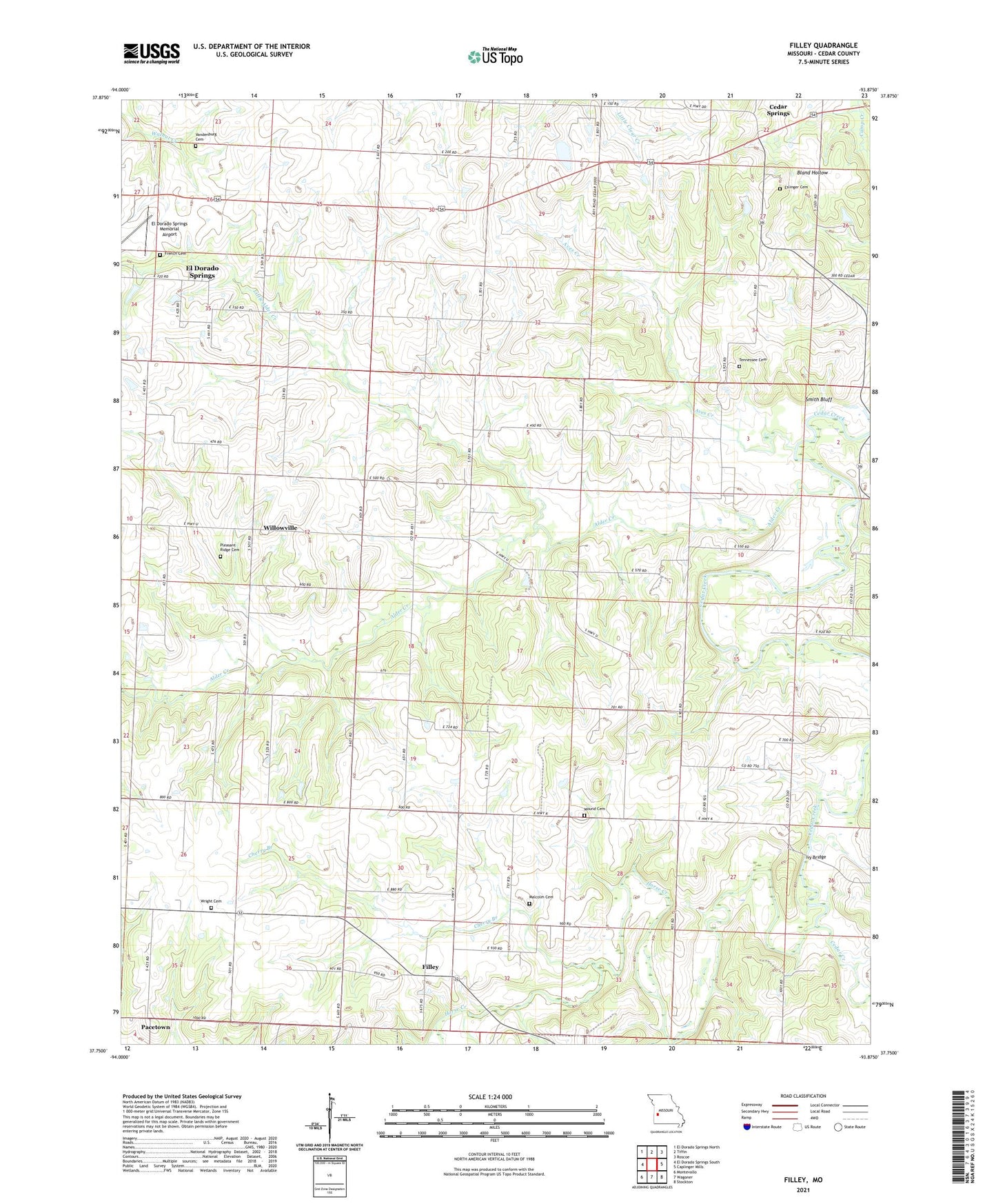
2021 topographic map quadrangle Filley in the state of Missouri. Scale: 1:24000. Based on the newly updated USGS 7.5' US Topo map series, this map is in the following counties: Cedar. The map contains contour data, water features, and other items you are used to seeing on USGS maps, but also has updated roads and other features. This is the next generation of topographic maps. Printed on high-quality waterproof paper with UV fade-resistant inks.
Quads adjacent to this one:
West: El Dorado Springs South
Northwest: El Dorado Springs North
North: Tiffin
Northeast: Roscoe
East: Caplinger Mills
Southeast: Stockton
South: Wagoner
Southwest: Montevallo
Contains the following named places: Alder Creek, Aves Creek, Cedar Springs, Cherry Branch, Cherry Valley School, Concord Church, Concord School, El Dorado Springs Memorial Airport, Eslinger Cemetery, Filley, Filley Community Park, Forest Grove, Forest Grove School, French Cemetery, Gordon School, Harriman Church, Hazel Dell Church, Hazel Dell School, Horse Creek, Ivy Bridge, Johnson School, Little Alder Creek, Malcolm Cemetery, Mound Cemetery, Oak Dell Church, Pacetown, Pleasant Ridge Cemetery, Pleasant Ridge Church, Pleasant Ridge School, Pleasant View, Smith Bluff, Southwest Missouri Psychiatric Rehabilitation Center, Tennessee Cemetery, Township of Box, Vandenburg Cemetery, Vandenburg School, Willowville, Wright Cemetery, Wright School, ZIP Code: 64744