MyTopo
Montevallo Missouri US Topo Map
Couldn't load pickup availability
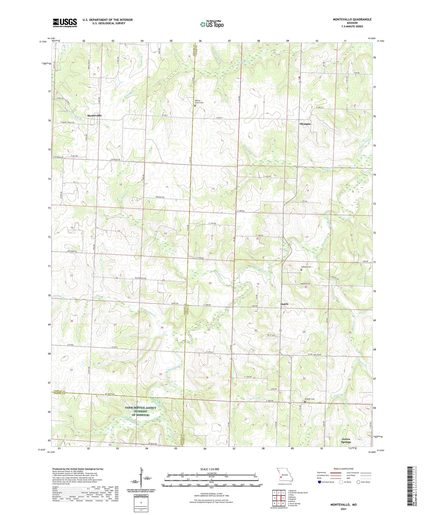
2021 topographic map quadrangle Montevallo in the state of Missouri. Scale: 1:24000. Based on the newly updated USGS 7.5' US Topo map series, this map is in the following counties: Cedar, Vernon, Barton. The map contains contour data, water features, and other items you are used to seeing on USGS maps, but also has updated roads and other features. This is the next generation of topographic maps. Printed on high-quality waterproof paper with UV fade-resistant inks.
Quads adjacent to this one:
West: Bellamy
Northwest: Dederick
North: El Dorado Springs South
Northeast: Filley
East: Wagoner
Southeast: Cedarville
South: Jerico Springs
Southwest: Milford
This map covers the same area as the classic USGS quad with code o37094f1.
Contains the following named places: Barnes School, Bear Creek, Boggy Springs School, Brasher Cemetery, Cynthia Creek, Diamond Grove School, Fair View School, Glade Springs Church, Glade Springs School, Green Ridge School, Hall Branch, Hall School, Hicklin Creek, Independence School, Jordan Creek, Lacey Branch, Little Bear Creek, Mapies Branch, Montevallo, Montevallo Academy, Number 658 Dam, Oldham Cemetery, Olympia, Olympia Rural Fire Department, Osiris, Potter Branch, Tom Branch, Township of Benton, Township of Montevallo, Walnut Grove Cemetery, Walnut Grove School, Wieland Branch, Wilkey Creek, Zodiac, Zodiac School