MyTopo
Fletcher Missouri US Topo Map
Couldn't load pickup availability
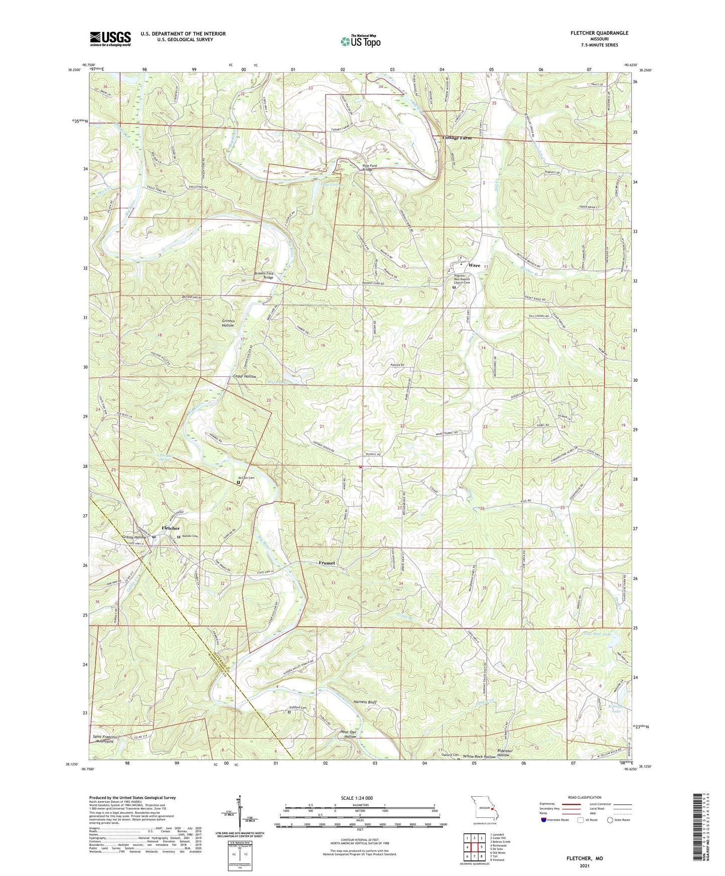
2021 topographic map quadrangle Fletcher in the state of Missouri. Scale: 1:24000. Based on the newly updated USGS 7.5' US Topo map series, this map is in the following counties: Jefferson, Washington. The map contains contour data, water features, and other items you are used to seeing on USGS maps, but also has updated roads and other features. This is the next generation of topographic maps. Printed on high-quality waterproof paper with UV fade-resistant inks.
Quads adjacent to this one:
West: Richwoods
Northwest: Lonedell
North: Cedar Hill
Northeast: Belews Creek
East: De Soto
Southeast: Vineland
South: Tiff
Southwest: Old Mines
Contains the following named places: Anderson Lake, Anderson Lake Dam, Brown School, Browns Ford Bridge, Browns School, Butcher Branch, Calico Creek, Cedar Hollow, Cottage Farm, De Soto Rural Fire Protection District Station 3, Ditch Creek, Flat Rock Lake Dam, Fletcher, Frumet, Grassy Hollow, Greys Branch, Grinnin Hollow, Gus Creek, Harness Bluff, Hoot Owl Hollow, Kinnippi Lake, Kinnippi Lake Dam, Kruze Creek, Lake George, Lake George Dam, Lake Lorene Dam, Mammoth School, Mammouth School, Maness Cemetery, Maness School, Maupin Creek, McCain Cemetery, McKean School, Mount Freedom, Mount Hope School, Oakland Cemetery, Paw-Paw Lake, Paw-Paw Lake Dam, Pine Ford Bridge, Pine Ford Lake, Reynolds Creek, Ridenour Hollow, Stafford Cemetery, Tar Blue Spring, Taylor Lake Dam, Township of Big River, Ware, Ware Lake, Ware Lake Dam, Yellow Rock Hollow