MyTopo
Goss Missouri US Topo Map
Couldn't load pickup availability
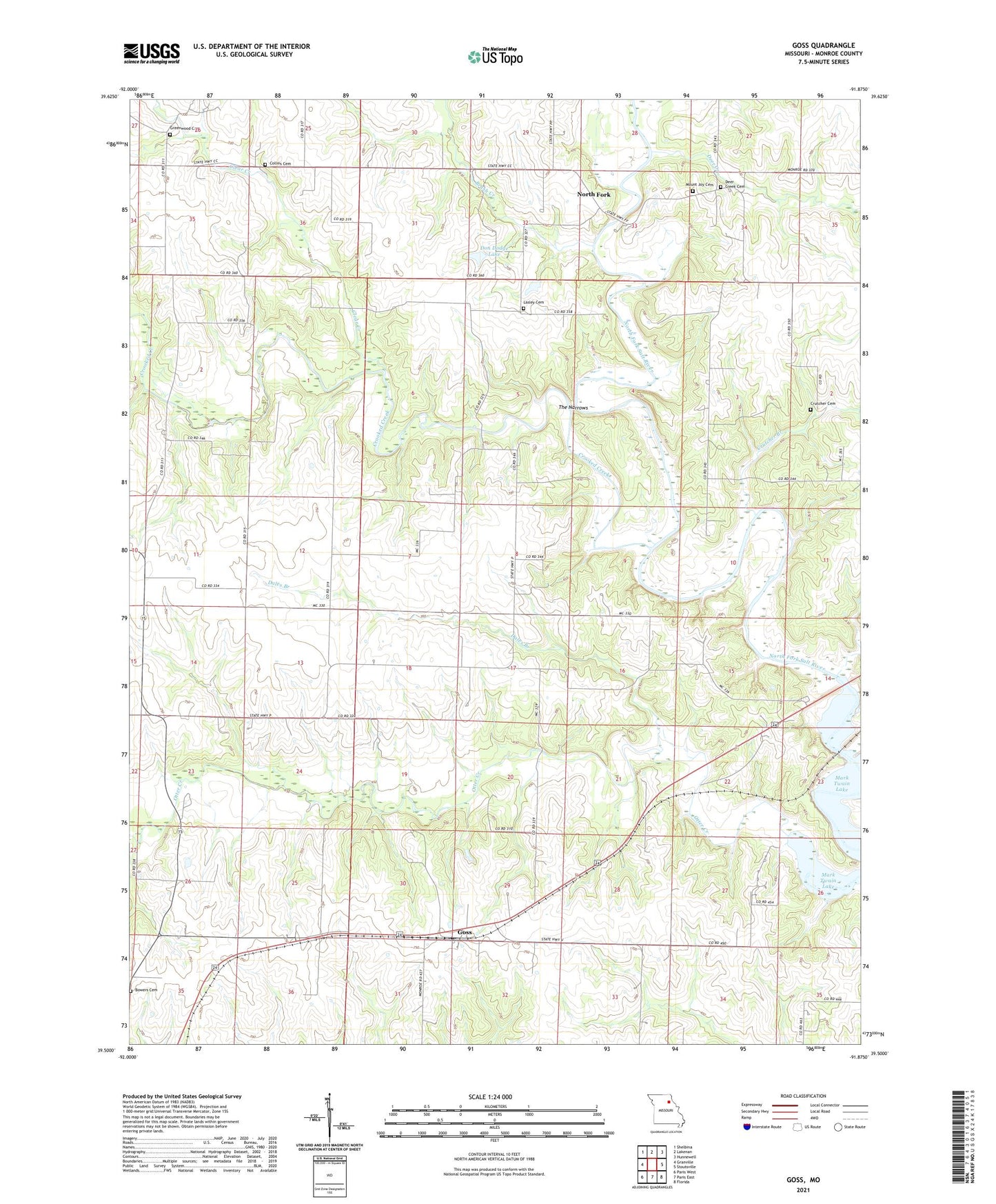
2021 topographic map quadrangle Goss in the state of Missouri. Scale: 1:24000. Based on the newly updated USGS 7.5' US Topo map series, this map is in the following counties: Monroe. The map contains contour data, water features, and other items you are used to seeing on USGS maps, but also has updated roads and other features. This is the next generation of topographic maps. Printed on high-quality waterproof paper with UV fade-resistant inks.
Quads adjacent to this one:
West: Granville
Northwest: Shelbina
North: Lakenan
Northeast: Hunnewell
East: Stoutsville
Southeast: Florida
South: Paris East
Southwest: Paris West
This map covers the same area as the classic USGS quad with code o39091e8.
Contains the following named places: Bowers Cemetery, Brush Creek, Charlick Dam, Clear Creek, Clinton School, Collins Cemetery, Crooked Creek, Crutcher Branch, Crutcher Cemetery, Crutcher School, Dales Branch, Deer Creek, Deer Creek Cemetery, Deer Creek School, Dodge Lake Section 32 Dam, Dodge Lake Section 5 Dam, Don Dodge Lake, Goss, Goss School, Greenwood Cemetery, Greenwood School, Hawkins, Johnson School, Lasley Cemetery, Marr School, Mount Joy Cemetery, North Fork, The Narrows, Town of Goss, Township of Washington, Washington School, Wright School