MyTopo
Amazonia Missouri US Topo Map
Couldn't load pickup availability
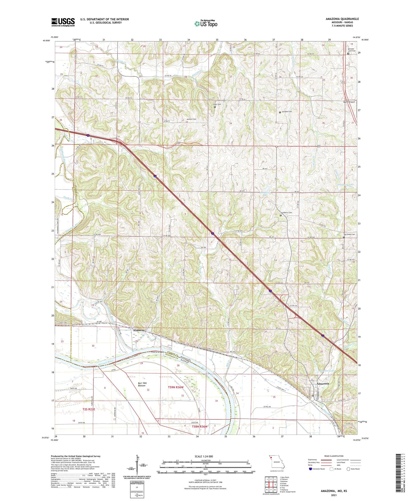
2021 topographic map quadrangle Amazonia in the states of Missouri, Kansas. Scale: 1:24000. Based on the newly updated USGS 7.5' US Topo map series, this map is in the following counties: Andrew, Doniphan, Holt. The map contains contour data, water features, and other items you are used to seeing on USGS maps, but also has updated roads and other features. This is the next generation of topographic maps. Printed on high-quality waterproof paper with UV fade-resistant inks.
Quads adjacent to this one:
West: Forbes
Northwest: New Point
North: Fillmore
Northeast: Bolckow
East: Savannah
Southeast: Saint Joseph North
South: Wathena
Southwest: Troy
This map covers the same area as the classic USGS quad with code o39094h8.
Contains the following named places: Amazonia, Amazonia Elementary School, Amazonia Post Office, Bennett Lane Cemetery, Bennett Lane School, Brand School, Burr Oak Bottom, Callen School, Caples Creek, Clizer Cemetery, Davis Roadside Park, Garlich Lake, Gee School, Gillispie Cemetery, Goodloe School, Hackberry Cemetery, Honey Creek, Hopkins Creek, Hummon School, Jackson Cemetery, Liggett School, Mill Creek, Mount Carmel Cemetery, Nodaway, Nodaway Census Designated Place, Nodaway Island School, Nodaway River, Paradise Lake, Paradise Lake Dam, Schweizer Lake, Schweizer Lake Dam, Smith Creek, Sollars Lake, Thompson Lake, Thompson Lake Dam, Township of Lincoln, Village of Amazonia, Whiteoak School, ZIP Code: 64421