
MyTopo
Fristoe Missouri US Topo Map
Couldn't load pickup availability
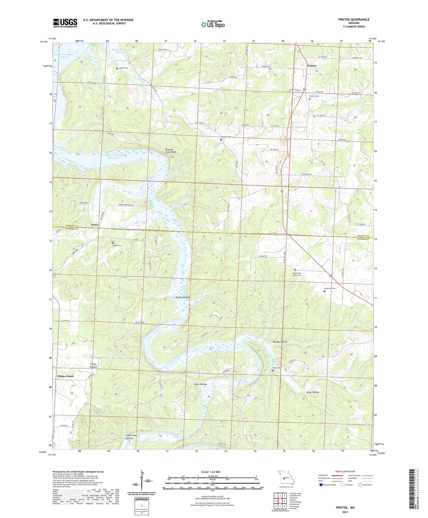
2021 topographic map quadrangle Fristoe in the state of Missouri. Scale: 1:24000. Based on the newly updated USGS 7.5' US Topo map series, this map is in the following counties: Hickory, Benton. The map contains contour data, water features, and other items you are used to seeing on USGS maps, but also has updated roads and other features. This is the next generation of topographic maps. Printed on high-quality waterproof paper with UV fade-resistant inks.
Quads adjacent to this one:
West: Quincy
Northwest: Warsaw West
North: Warsaw East
Northeast: Edwards
East: Cross Timbers
Southeast: Preston
South: Hermitage
Southwest: Wheatland
Contains the following named places: Avery, Avery School, Bartville School, Bell Branch, Bone Hollow, Brown Branch, Brushy Hollow, Buzzard Cave Bluff, Concord Cemetery, Concord School, Dickirson Cemetery, Fristoe, Fristoe Cemetery, Fristoe School, Hart Cemetery, Hartville School, Jones Cemetery, Joplin Cemetery, Liberty School, Little Mill Creek, Little Mill Creek Ford, Locust Ridge School, Mining Hollow, Mount Herman School, Mount View School, Old Baptist Church, Phillips Ford, Pippens Cemetery, Pomme de Terre River, Round Bottom Ford, Salley Branch, Seedtick Mine, Sloan Hollow, South New Home Cemetery, Spring Branch Church, Sugarcamp Hollow, White Cloud


