MyTopo
Wheatland Missouri US Topo Map
Couldn't load pickup availability
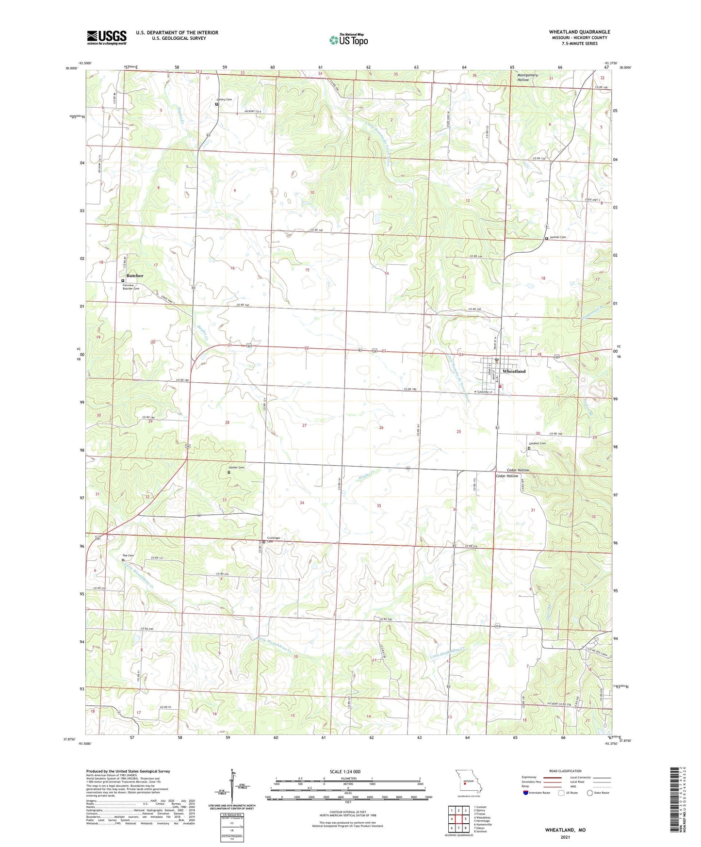
2021 topographic map quadrangle Wheatland in the state of Missouri. Scale: 1:24000. Based on the newly updated USGS 7.5' US Topo map series, this map is in the following counties: Hickory. The map contains contour data, water features, and other items you are used to seeing on USGS maps, but also has updated roads and other features. This is the next generation of topographic maps. Printed on high-quality waterproof paper with UV fade-resistant inks.
Quads adjacent to this one:
West: Weaubleau
Northwest: Iconium
North: Quincy
Northeast: Fristoe
East: Hermitage
Southeast: Sentinel
South: Elkton
Southwest: Humansville
This map covers the same area as the classic USGS quad with code o37093h4.
Contains the following named places: Butcher, City of Wheatland, Concord School, Crutsinger Cemetery, Fairview Butcher Cemetery, Fairview School, Gardner Cemetery, Gentry Cemetery, Gerber Cemetery, Miller School, Poe Cemetery, Pomme Aero Airport, Salem School, Skyriders Airport, Sumner Cemetery, Township of Wheatland, Wheatland, Wheatland Post Office, Wheatland Prairie, Wheatland Volunteer Fire Department Wheatland Station 1, White Cloud School, ZIP Codes: 65774, 65779