MyTopo
Hermitage Missouri US Topo Map
Couldn't load pickup availability
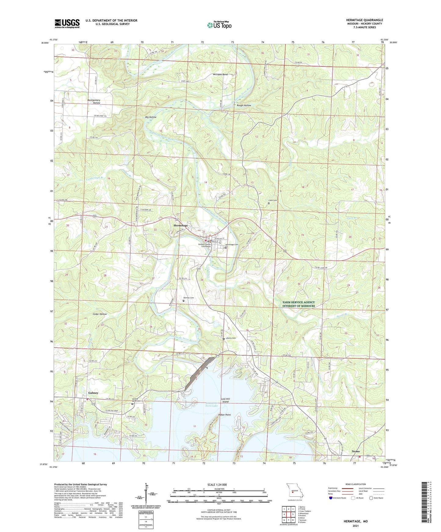
2021 topographic map quadrangle Hermitage in the state of Missouri. Scale: 1:24000. Based on the newly updated USGS 7.5' US Topo map series, this map is in the following counties: Hickory. The map contains contour data, water features, and other items you are used to seeing on USGS maps, but also has updated roads and other features. This is the next generation of topographic maps. Printed on high-quality waterproof paper with UV fade-resistant inks.
Quads adjacent to this one:
West: Wheatland
Northwest: Quincy
North: Fristoe
Northeast: Cross Timbers
East: Preston
Southeast: Urbana
South: Sentinel
Southwest: Elkton
This map covers the same area as the classic USGS quad with code o37093h3.
Contains the following named places: Big Hollow, Carsons Corner, Cedar Hollow, City of Hermitage, Clark Branch, Clark Cemetery, Clark School, Crane Creek, Cross Timbers Public Use Area, Dam Site Public Use Area, Dooley Bend, Dooley Bend Cemetery, Dooley Bend School, Dorman Cemetery, Galmey, Galmey Volunteer Fire Department, Green Branch, Hermitage, Hermitage Cemetery, Hermitage Post Office, Hermitage Volunteer Fire Department, Hermitage Volunteer Fire Department Station 2, Hickory County, Hickory County Emergency Management Rescue, Hickory County Sheriff's Office, Hopewell School, Indian Backbone, Indian Point, Jordan Branch, Liberty Cemetery, Lindley Creek, Lost Hill Island, Macedonia Church, Mill Creek, Nemo, Oak Grove Communtiy Hall, Outlet Public Use Area, Peterson Mine, Pleasant Hill Community Hall, Pomme de Terre Dam, Quarry Point Public Use Area, Rough Hollow, Saint Bernadette Church, Short Branch, Swede Branch, Township of Center, Township of Hermitage, Vanderman Branch, Wheatland Public Use Area, Williams Bend, ZIP Code: 65668