MyTopo
Preston Missouri US Topo Map
Couldn't load pickup availability
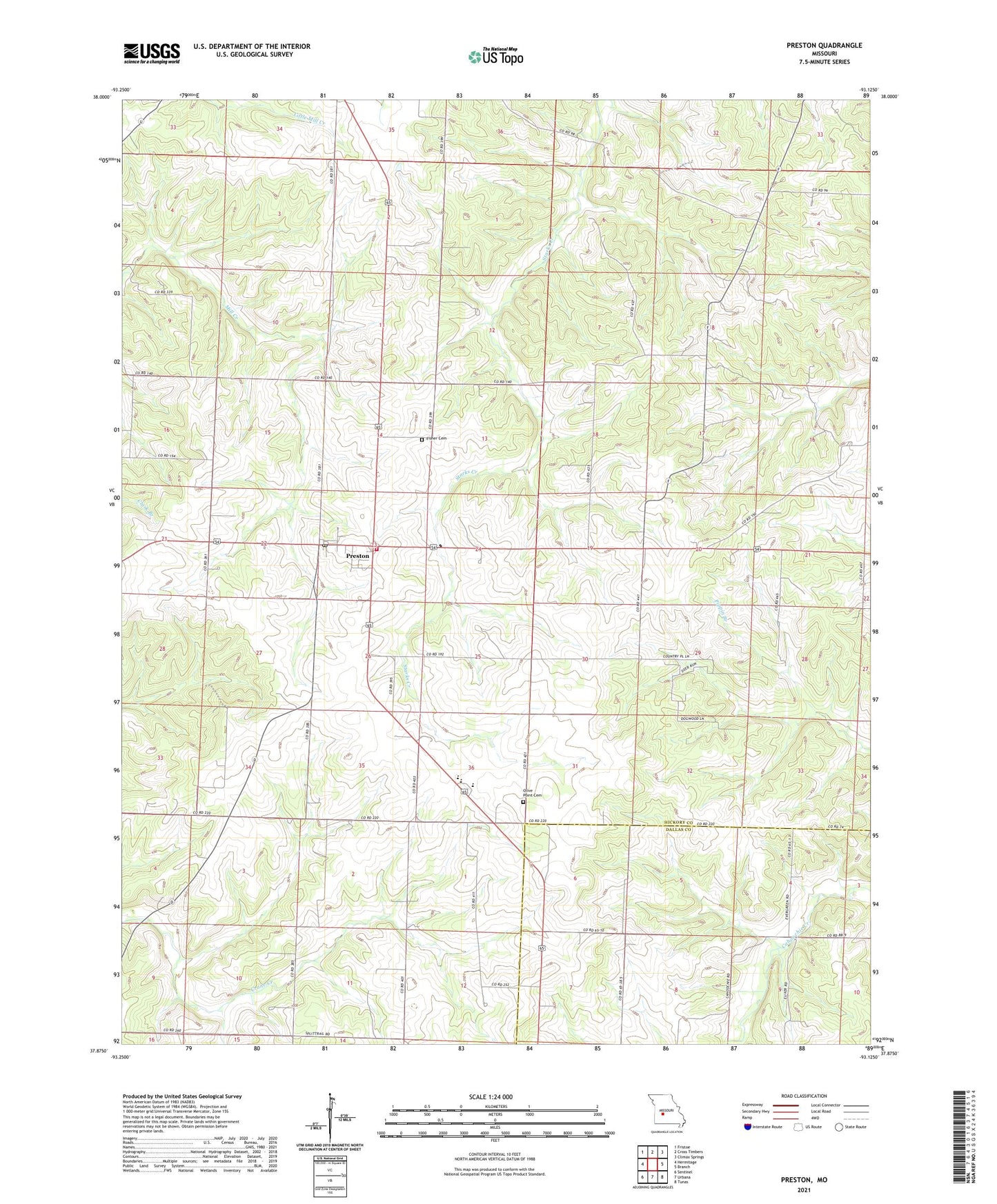
2021 topographic map quadrangle Preston in the state of Missouri. Scale: 1:24000. Based on the newly updated USGS 7.5' US Topo map series, this map is in the following counties: Hickory, Dallas. The map contains contour data, water features, and other items you are used to seeing on USGS maps, but also has updated roads and other features. This is the next generation of topographic maps. Printed on high-quality waterproof paper with UV fade-resistant inks.
Quads adjacent to this one:
West: Hermitage
Northwest: Fristoe
North: Cross Timbers
Northeast: Climax Springs
East: Branch
Southeast: Tunas
South: Urbana
Southwest: Sentinel
This map covers the same area as the classic USGS quad with code o37093h2.
Contains the following named places: Browder School, Cahoochie Airport, Fisher Cemetery, Lakes Country Planning Region, Lone Spring, Morgan School, New Haven School, Olive Point Cemetery, Olive Point Church, Olive Point School, Pleasant Valley School, Preston, Preston Area Volunteer Fire Department, Preston Post Office, Skyline High School, Township of Stark, Village of Preston, ZIP Code: 65732