MyTopo
Calhoun West Missouri US Topo Map
Couldn't load pickup availability
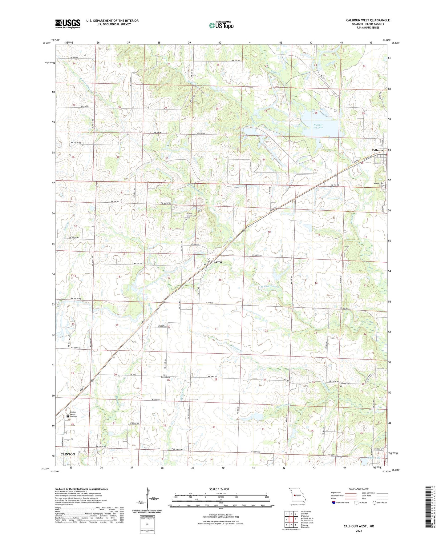
2021 topographic map quadrangle Calhoun West in the state of Missouri. Scale: 1:24000. Based on the newly updated USGS 7.5' US Topo map series, this map is in the following counties: Henry. The map contains contour data, water features, and other items you are used to seeing on USGS maps, but also has updated roads and other features. This is the next generation of topographic maps. Printed on high-quality waterproof paper with UV fade-resistant inks.
Quads adjacent to this one:
West: Clinton North
Northwest: Chilhowee
North: Leeton
Northeast: Windsor
East: Calhoun East
Southeast: Leesville
South: Gaines
Southwest: Clinton South
This map covers the same area as the classic USGS quad with code o38093d6.
Contains the following named places: Bronaugh Church, Bronaugh School, Calhoun, Calhoun Cemetery, Calhoun Elementary School, Calhoun High School, City of Calhoun, Clinton Memory Gardens, Combs Cemetery, Connor O. Fewel Conservation Area, Deer Creek School, Dody Lake Dam, Drakes Chapel, East Lake School, Harrelson Creek, Highland School, Hinton Lake Dam, Hutcherson Lake Dam, Lewis, Lewis School, Merritt School, Mount Gilead Church, Number 111 Lake, O'Dell Lake, O'Dell Lake Dam, Plum Grove School, Redding Mine, Spangler Mine, Tebo Freshwater Lake Dam, Township of Deer Creek, Union School, Wade Creek, Wall Lake Dam