MyTopo
Leesville Missouri US Topo Map
Couldn't load pickup availability
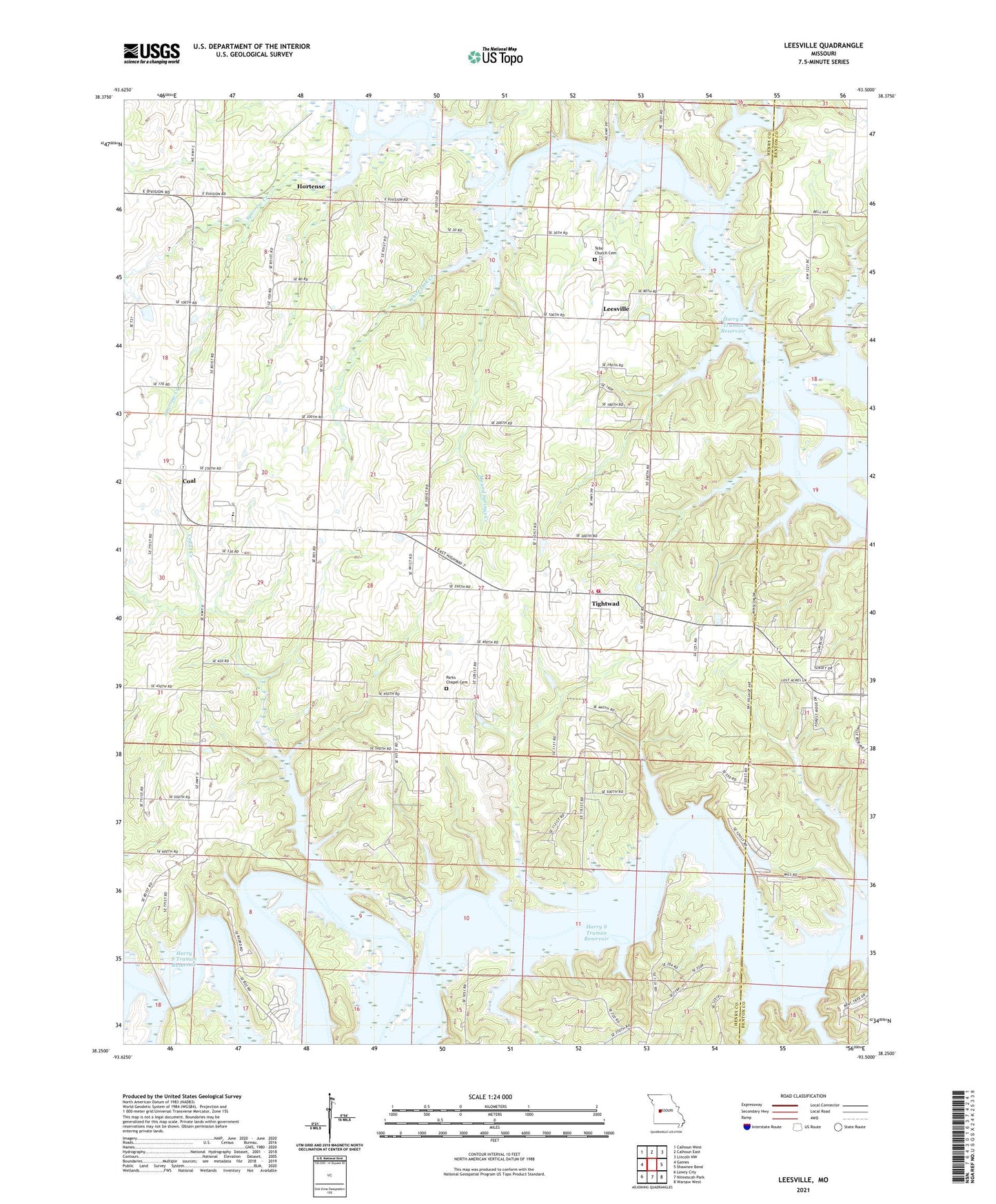
2021 topographic map quadrangle Leesville in the state of Missouri. Scale: 1:24000. Based on the newly updated USGS 7.5' US Topo map series, this map is in the following counties: Henry, Benton. The map contains contour data, water features, and other items you are used to seeing on USGS maps, but also has updated roads and other features. This is the next generation of topographic maps. Printed on high-quality waterproof paper with UV fade-resistant inks.
Quads adjacent to this one:
West: Gaines
Northwest: Calhoun West
North: Calhoun East
Northeast: Lincoln NW
East: Shawnee Bend
Southeast: Warsaw West
South: Ninnescah Park
Southwest: Lowry City
This map covers the same area as the classic USGS quad with code o38093c5.
Contains the following named places: Barker Creek, Brush Creek, Cedar Creek, Clear Creek, Coal, Coal School, Fargo School, Hortense, Hortense Post Office, Hortense School, Lawler School, Leesville, Leesville Elementary School, Leesville School, Leesville State Wildlife Management Area, Logan School, Mirror Lake Number 1 Dam, Mirror Lake Number 2 Dam, Mound Springs Creek, Mound Springs School, Norfleet Lake Dam, Number 135 Reservoir, Parks Chapel, Parks Chapel Cemetery, Plumlee Lake Dam, Shady Grove School, Sparrow Creek, Tebo Church, Tebo Church Cemetery, Tebo Islands State Wildlife Management Area, Tightwad, Tightwad Fire Protection District, Township of Leesville, Turner School, Village of Tightwad, Western Ozarks, White Oak Creek, Windsor Crossing Public Use Area