MyTopo
Gainesville Missouri US Topo Map
Couldn't load pickup availability
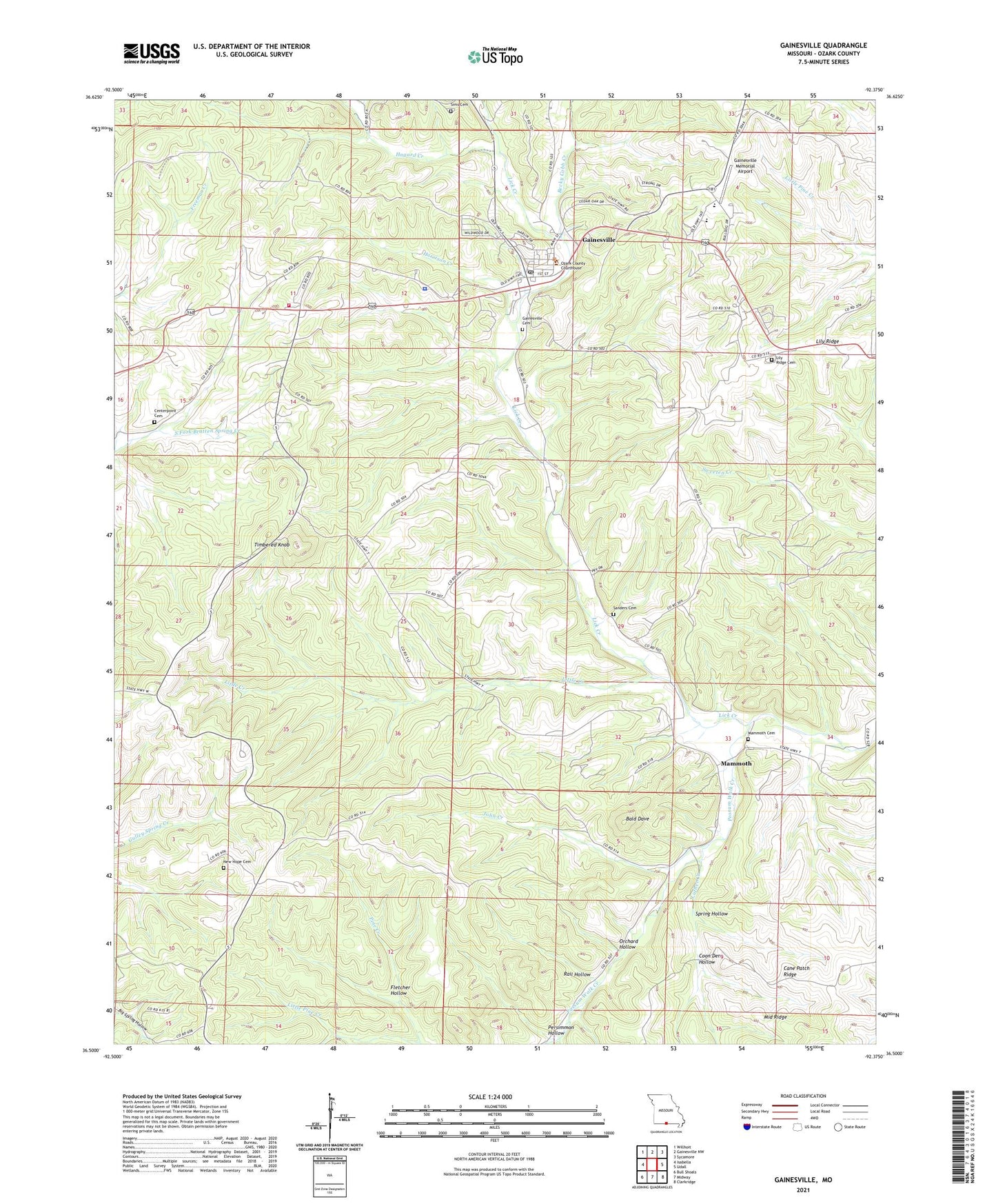
2021 topographic map quadrangle Gainesville in the state of Missouri. Scale: 1:24000. Based on the newly updated USGS 7.5' US Topo map series, this map is in the following counties: Ozark. The map contains contour data, water features, and other items you are used to seeing on USGS maps, but also has updated roads and other features. This is the next generation of topographic maps. Printed on high-quality waterproof paper with UV fade-resistant inks.
Quads adjacent to this one:
West: Isabella
Northwest: Willhoit
North: Gainesville NW
Northeast: Sycamore
East: Udall
Southeast: Clarkridge
South: Midway
Southwest: Bull Shoals
Contains the following named places: Assembly of God Church, Bald Dave, Becky Cobb Creek, Cane Patch Ridge, Center Point Church, City of Gainesville, Coon Den Hollow, Fletcher Hollow, Full Gospel Church, Gainesville, Gainesville Cemetery, Gainesville Fire Department, Gainesville High School, Gainesville Memorial Airport, Gainesville Police Department, Gainesville Post Office, Harrison Creek, Hogard Creek, John Creek, KMAC-FM (Gainesville), Lilly Ridge School, Lily Ridge, Lily Ridge Church, Little Creek, Little Pine Creek, Luther Creek, Mammoth, Mammoth Cemetery, Merrell Lake Dam, Merrill Lake, Middle Ridge, Never Fail School, New Hope Cemetery, New Hope School, Orchard Hollow, Ozark County Sheriff's Office, Persimmon Hollow, Pontiac / Price Place Volunteer Fire Department Station 2, Possum Walk Creek, Rail Hollow, Saint William Church, Sanders Cemetery, Sims Cemetery, Spring Hollow, Timbered Knob, Township of Bridges, Township of West Bridges, ZIP Code: 65655