MyTopo
Sycamore Missouri US Topo Map
Couldn't load pickup availability
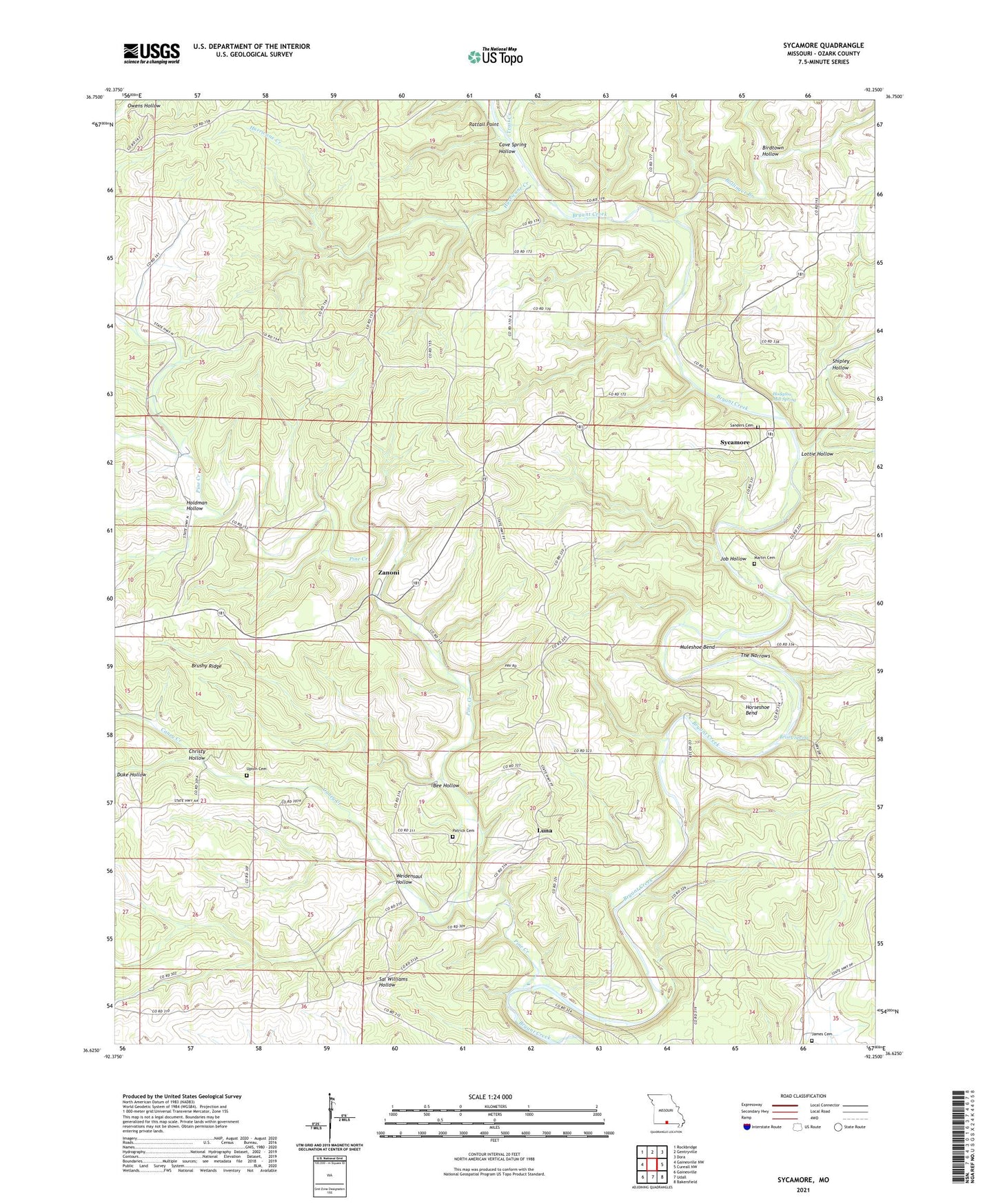
2021 topographic map quadrangle Sycamore in the state of Missouri. Scale: 1:24000. Based on the newly updated USGS 7.5' US Topo map series, this map is in the following counties: Ozark. The map contains contour data, water features, and other items you are used to seeing on USGS maps, but also has updated roads and other features. This is the next generation of topographic maps. Printed on high-quality waterproof paper with UV fade-resistant inks.
Quads adjacent to this one:
West: Gainesville NW
Northwest: Rockbridge
North: Gentryville
Northeast: Dora
East: Cureall NW
Southeast: Bakersfield
South: Udall
Southwest: Gainesville
This map covers the same area as the classic USGS quad with code o36092f3.
Contains the following named places: Bee Hollow, Birdtown Hollow, Bollinger Branch, Brixey Spring, Brushy Ridge, Bushong School, Caney Creek, Caney School, Cave Spring Hollow, Christy Hollow, High View School, Hodgson Mill Spring, Holdman Hollow, Horseshoe Bend, Hurricane Creek, Job Hollow, Lottie Hollow, Luna, Luna Church, Luna School, Martin Cemetery, Muleshoe Bend, Needmore Church, Negro Ford, New Hope School, Osburn Ford, Patrick Cemetery, Pine Creek, Pleasant Hill School, Rattail Point, Russel Ford, Sanders Cemetery, Sanfield Ford, School Number 88, Shipley Hollow, Smith Chapel, Sycamore, The Narrows, Township of Pine Creek, Trail Creek, Upton Cemetery, Weidensaul Hollow, Zanoni, ZIP Codes: 65618, 65784