MyTopo
Mill Grove Missouri US Topo Map
Couldn't load pickup availability
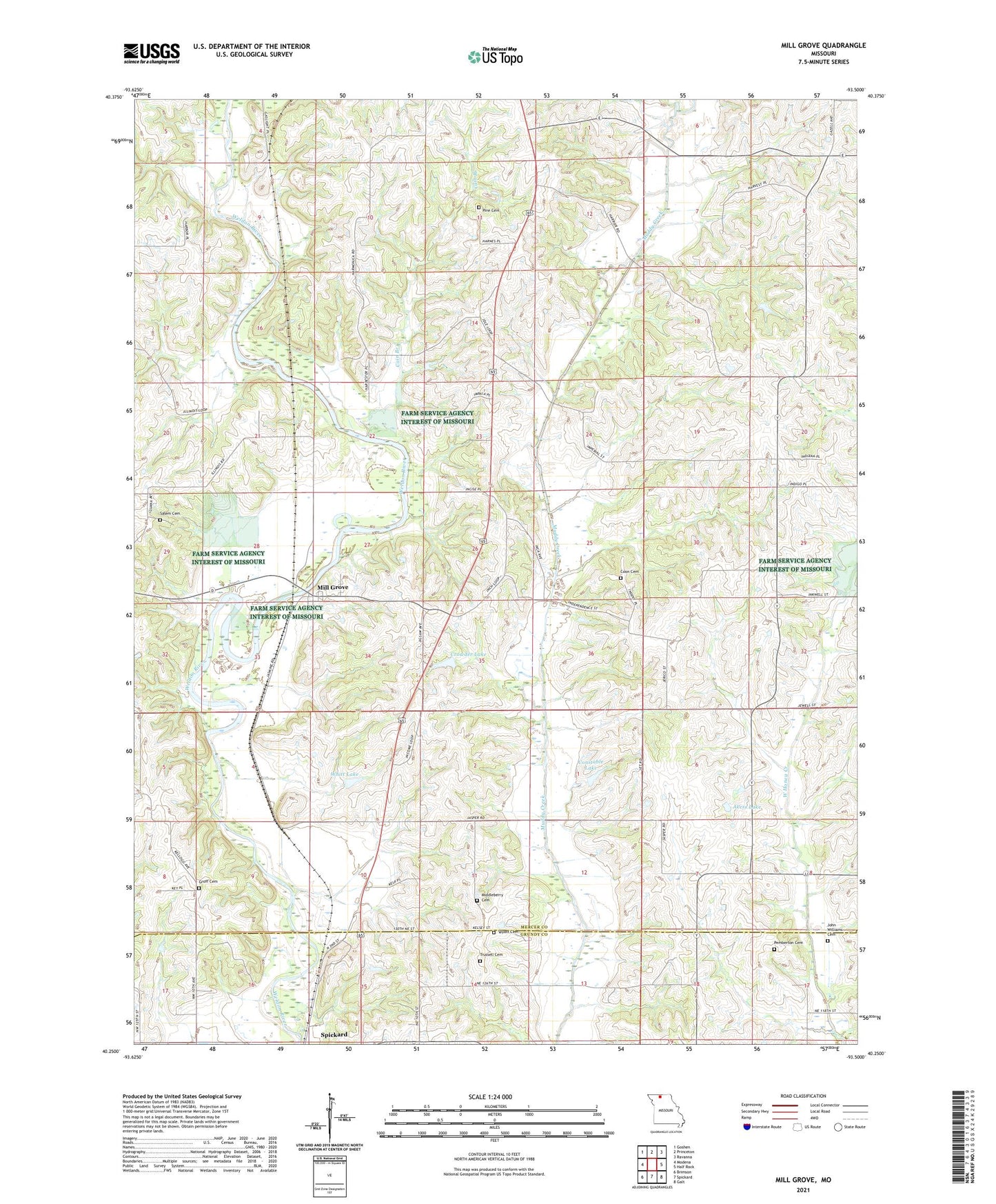
2021 topographic map quadrangle Mill Grove in the state of Missouri. Scale: 1:24000. Based on the newly updated USGS 7.5' US Topo map series, this map is in the following counties: Mercer, Grundy. The map contains contour data, water features, and other items you are used to seeing on USGS maps, but also has updated roads and other features. This is the next generation of topographic maps. Printed on high-quality waterproof paper with UV fade-resistant inks.
Quads adjacent to this one:
West: Modena
Northwest: Goshen
North: Princeton
Northeast: Ravanna
East: Half Rock
Southeast: Galt
South: Spickard
Southwest: Brimson
This map covers the same area as the classic USGS quad with code o40093c5.
Contains the following named places: Akers Lake, Akers Lake Dam, Antioch Church, Cain Branch, Calvert School, Constable Lake, Constable Lake Dam, Coon Cemetery, Coon Church, Crowder Lake, Crowder Lake Dam, East High Point School, East Pine School, Franklin School, Groff Cemetery, John Williams Cemetery, Lone Star School, Middleberry Cemetery, Mill Grove, Oak School, Pemberton Cemetery, Pine Cemetery, Salem Cemetery, Township of Washington, Trussell Cemetery, Victor School, West Pine School, Whitt Lake, Whitt Lake Dam, Wilds School, Wyatt Cemetery, ZIP Code: 64673