MyTopo
Gideon Missouri US Topo Map
Couldn't load pickup availability
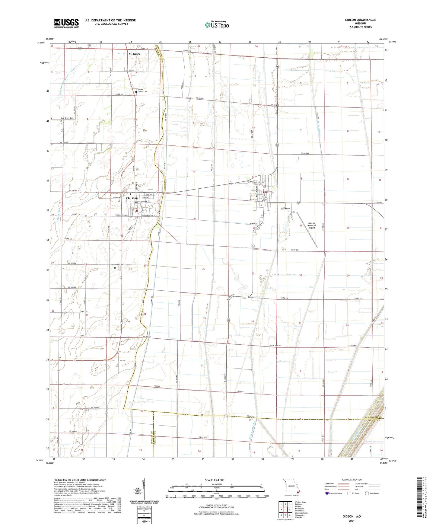
2021 topographic map quadrangle Gideon in the state of Missouri. Scale: 1:24000. Based on the newly updated USGS 7.5' US Topo map series, this map is in the following counties: New Madrid, Dunklin, Pemiscot. The map contains contour data, water features, and other items you are used to seeing on USGS maps, but also has updated roads and other features. This is the next generation of topographic maps. Printed on high-quality waterproof paper with UV fade-resistant inks.
Quads adjacent to this one:
West: Campbell
Northwest: Valley Ridge
North: Malden
Northeast: Parma
East: Boekerton
Southeast: Wardell
South: Bragg City
Southwest: Kennett North
Contains the following named places: City of Clarkton, City of Gideon, Clarkton, Clarkton Post Office, Clarkton Volunteer Fire Department, Crossroads Church, Ditch Number 1, Ditch Number 258, Ditch Number 293, Ditch Number 4, Douglas Grove Church, Dunn, Gideon, Gideon Memorial Airport, Gideon Post Office, Gideon Volunteer Fire Department, Glendale, Hedgerow School, Little Walnut School, Main Ditch, Main Ditch District Number 17, Marlow, Marlow Chapel, Marlow School, McBride School, McGuire, Miller School, Moark, Mount Gilead Cemetery, Mount Gilead Church, New Hope Church, Oak Grove Cemetery, Oak Grove Church, Oak Grove School, Page, Peanut School, Sarff, Stanfield Cemetery, Stanfield Church, Stanfield General Church, Sweetwater Camp, Township of Anderson, Township of Freeborn, Union Grove Church, Wrightsville, Wrightsville Post Office, Zion School, ZIP Codes: 63837, 63848