MyTopo
Allbright Missouri US Topo Map
Couldn't load pickup availability
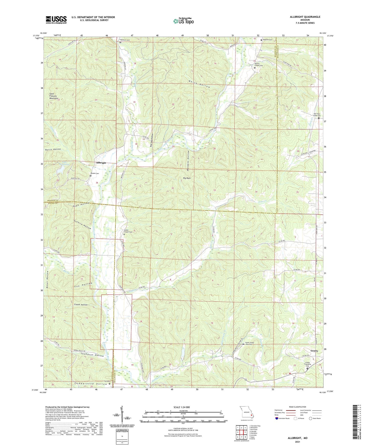
2021 topographic map quadrangle Allbright in the state of Missouri. Scale: 1:24000. Based on the newly updated USGS 7.5' US Topo map series, this map is in the following counties: Bollinger, Madison, Wayne. The map contains contour data, water features, and other items you are used to seeing on USGS maps, but also has updated roads and other features. This is the next generation of topographic maps. Printed on high-quality waterproof paper with UV fade-resistant inks.
Quads adjacent to this one:
West: Cascade
Northwest: Cherokee Pass
North: Marquand
Northeast: Hurricane
East: Glenallen
Southeast: Zalma
South: Gipsy
Southwest: Lowndes
This map covers the same area as the classic USGS quad with code o37090c2.
Contains the following named places: Allbright, Allbright School, Big Creek, Big Rock, Blaylock Cemetery, Britton Lake Dam, Camp Number 32, Campground Hollow, Castor, Cheek Hollow, Fox Hollow, Friendship Church, Glenallen Fire Protection Association Station 2, Grassy School, Guthrie Hollow, Ivy Cemetery, Kinder Chapel, Kinder Chapel Cemetery, Lake Woaplanne, Little Grassy Creek, Lodge, Lower Grassy - Rea Cemetery, Millers Chapel, Moore School, Moores Chapel, Moores Chapel Cemetery, Moser Hollow, Norris Hollow, Peal School, Pentecost Church, Pound School, Pugh Hollow, Red Sea Hollow, Rhodes Cemetery, Rickman Cemetery, Shetley Creek, Thompson Hollow, Thompson Hollow School, Township of Big Creek, Township of Filmore, Trace Creek, Trace Creek Church, White Hollow, Wolfpen Hollow, ZIP Code: 63751