MyTopo
Gipsy Missouri US Topo Map
Couldn't load pickup availability
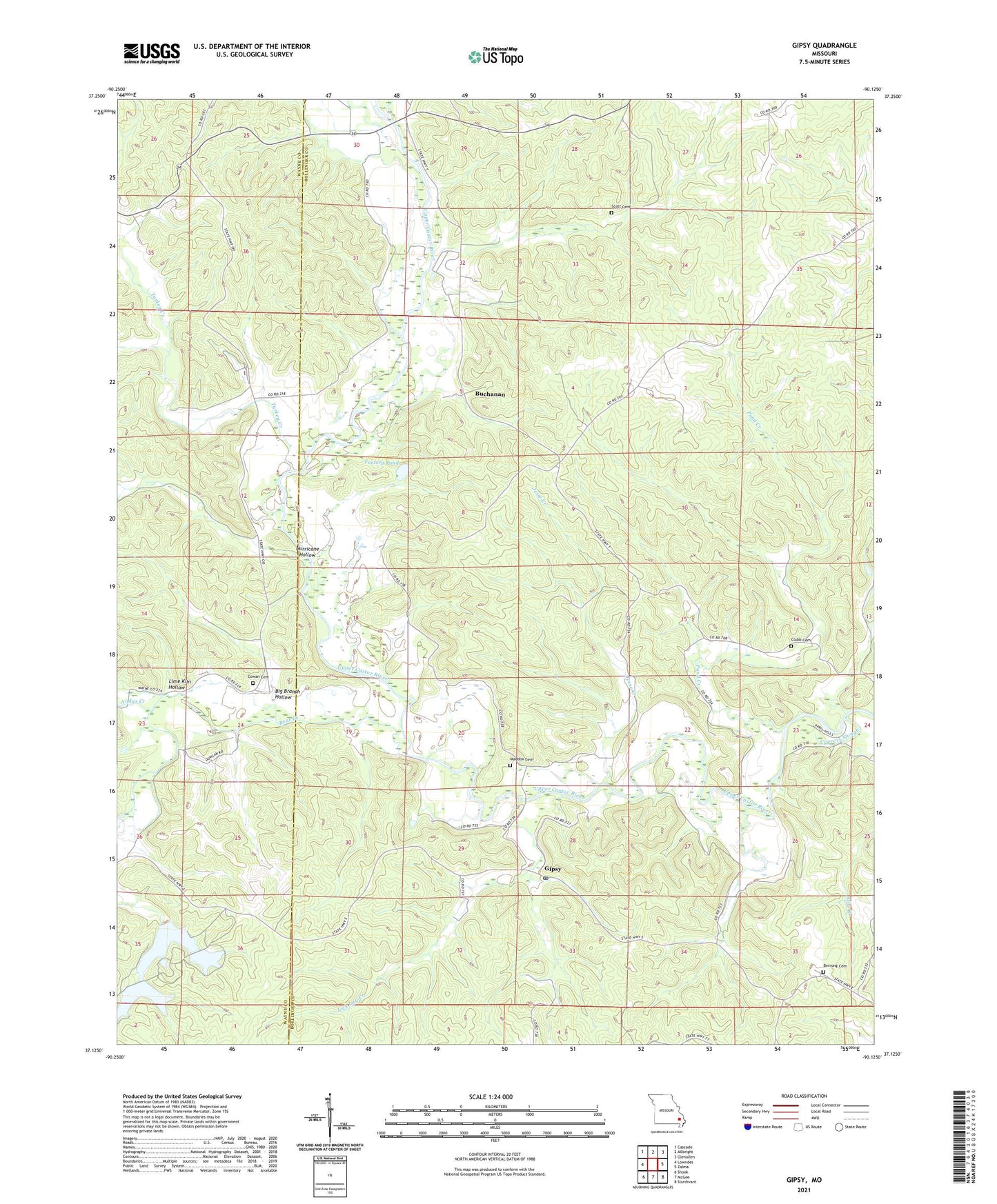
2021 topographic map quadrangle Gipsy in the state of Missouri. Scale: 1:24000. Based on the newly updated USGS 7.5' US Topo map series, this map is in the following counties: Bollinger, Wayne. The map contains contour data, water features, and other items you are used to seeing on USGS maps, but also has updated roads and other features. This is the next generation of topographic maps. Printed on high-quality waterproof paper with UV fade-resistant inks.
Quads adjacent to this one:
West: Lowndes
Northwest: Cascade
North: Allbright
Northeast: Glenallen
East: Zalma
Southeast: Sturdivant
South: McGee
Southwest: Shook
This map covers the same area as the classic USGS quad with code o37090b2.
Contains the following named places: Andys Creek, Bear Creek, Berrong Church, Big Branch Hollow, Blue Pond, Buchanan, Buchanan School, Castor River State Forest, Choat, Choat Post Office, Clubb Cemetery, Cowan Cemetery, Cowan Church, Cypress Slough, Factory Pond, Gipsy, Gipsy Post Office, Grassy Creek, Hurricane Hollow, Jesse Creek, Lake Janna Dam, Lake Julia Dam, Lake of the Pines Dam, Liberty Church, Lick Log Creek, Lime Kiln Hollow, Little Vine Church, Little Vine School, Lower Turkey Creek School, Maddox Cemetery, Pleasant Valley Church, Pond Creek, Pond Creek School, Scott Cemetery, Sitzke Store, Turkey Creek, Turners Dream Lake Dam, ZIP Code: 63750