MyTopo
Glover Missouri US Topo Map
Couldn't load pickup availability
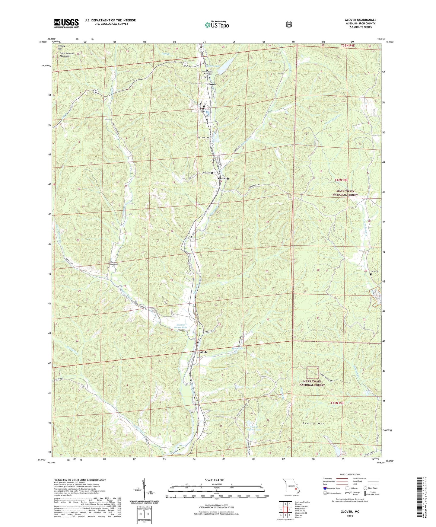
2021 topographic map quadrangle Glover in the state of Missouri. Scale: 1:24000. Based on the newly updated USGS 7.5' US Topo map series, this map is in the following counties: Iron. The map contains contour data, water features, and other items you are used to seeing on USGS maps, but also has updated roads and other features. This is the next generation of topographic maps. Printed on high-quality waterproof paper with UV fade-resistant inks.
Quads adjacent to this one:
West: Lesterville
Northwest: Johnson Shut-Ins
North: Ironton
Northeast: Lake Killarney
East: Des Arc NE
Southeast: Brunot
South: Des Arc
Southwest: Lesterville SE
Contains the following named places: Asarco Lake, Asarco Lake Dam, Asarco Section 11 Lower Dam, Asarco Section 11 Upper Dam, Berryman, Big Creek Church, Blue Hole, Bollinger School, Carver Creek, Carver Creek School, Chloride, Crane Lake Picnic Area, Crane Pond School, Emilys Chapel, Emilys Chapel Cemetery, Glover, Glover Baptist Church, Glover Baptist Church Cemetery, Glover School, Goff Branch, Grassy Mountain, Huff Cemetery, Hurst Cemetery, Lawless Lake Dam, Little Carver Creek, Little Creek, Number 466 Dam, Number 809 Dam, Richland Creek, Russell Number Two Iron Bank, Sabula, Section House Hole, Township of Liberty, Walnut Hollow Lake, Walnut Hollow Lake Dam, Walnut Hollow Lake Section 2 Dam, ZIP Code: 63620