MyTopo
Lesterville Missouri US Topo Map
Couldn't load pickup availability
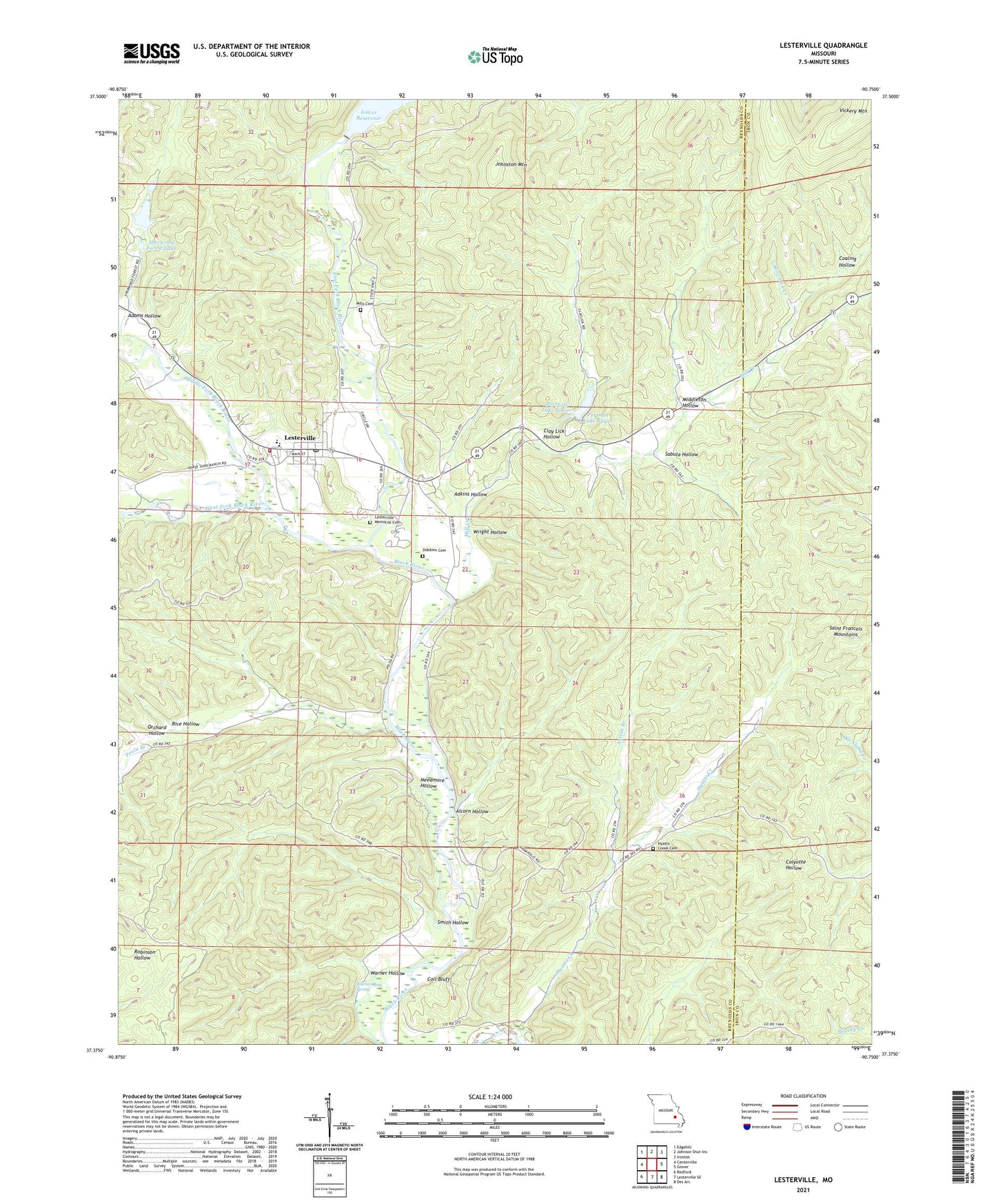
2021 topographic map quadrangle Lesterville in the state of Missouri. Scale: 1:24000. Based on the newly updated USGS 7.5' US Topo map series, this map is in the following counties: Reynolds, Iron. The map contains contour data, water features, and other items you are used to seeing on USGS maps, but also has updated roads and other features. This is the next generation of topographic maps. Printed on high-quality waterproof paper with UV fade-resistant inks.
Quads adjacent to this one:
West: Centerville
Northwest: Edgehill
North: Johnson Shut-Ins
Northeast: Ironton
East: Glover
Southeast: Des Arc
South: Lesterville SE
Southwest: Redford
This map covers the same area as the classic USGS quad with code o37090d7.
Contains the following named places: Adams Hollow, Adkins Hollow, Alcorn Hollow, Clay Lick Hollow, Coaling Hollow, Coil Bluff, Dobbins Cemetery, East Fork Black River, Hyatts Creek Cemetery, Hyatts Creek School, Johnston Mountain, Lake Springs, Lesterville, Lesterville Memorial Cemetery, Lesterville Post Office, Middle Fork Black River, Middleton Hollow, Mill Creek, Mire Lick Creek, Needmore Hollow, Northern Reynolds County Fire Protection District, Okkapassa Dam, Orchard Hollow, Our Lady of Sorrow Church, Peola Branch, Peola School, Pershall Lake Lower, Pershall Lake Upper, Pershall Lakes, Rice Hollow, Sabula Hollow, Scudder Camp, Sela Land Dam, Sherwood Forest Lake, Smith Hollow, Smithboro, Sutton Branch, Taum Sauk Lower Dam, Township of Lesterville, Vickery Mountain, Warner Bay Spring, Warner Hollow, West Fork Black River, Wiggins Ozark Camp Dam, Wright Hollow, ZIP Code: 63654