MyTopo
Des Arc Missouri US Topo Map
Couldn't load pickup availability
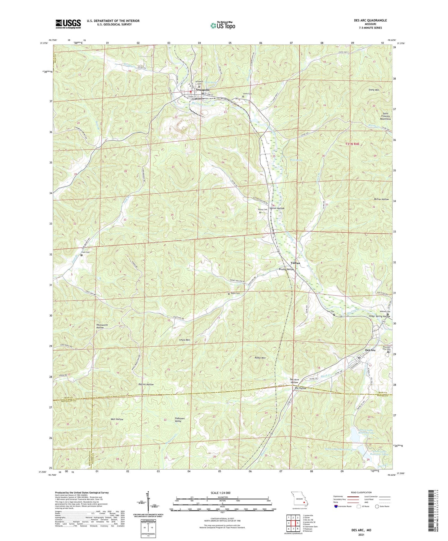
2021 topographic map quadrangle Des Arc in the state of Missouri. Scale: 1:24000. Based on the newly updated USGS 7.5' US Topo map series, this map is in the following counties: Iron, Wayne, Reynolds. The map contains contour data, water features, and other items you are used to seeing on USGS maps, but also has updated roads and other features. This is the next generation of topographic maps. Printed on high-quality waterproof paper with UV fade-resistant inks.
Quads adjacent to this one:
West: Lesterville SE
Northwest: Lesterville
North: Glover
Northeast: Des Arc NE
East: Brunot
Southeast: Patterson
South: Piedmont
Southwest: Clearwater Dam
This map covers the same area as the classic USGS quad with code o37090c6.
Contains the following named places: Annapolis, Annapolis Lead Mine, Annapolis Post Office, Black Creek, Brushy Creek, Brushy Hollow, Cedar Spring Hollow, Chain of Lakes, Chain of Lakes Dam Number 1, Chain of Lakes Dam Number 2, Chain of Lakes Dam Number 3, City of Annapolis, Des Acre Hollow, Des Arc, Dinger Iron Bank, Dry Hollow, Funk Cemetery, Funk School, Goose Creek, International Speciality Products Minerals Annapolis Quarry, Island Branch, Kinney Branch, Leadanna, Lewis Cemetery, Lewis Mountain, Mountain View Cemetery, New Peace and Harmony Church, Ruble Cemetery, Ruble Mountain, Seven Lakes Reservoir One, Seven Lakes Reservoir Three, Seven Lakes Reservoir Two, Singer Iron Bank, Sisk Cemetery, Slab Pond, Slabtown Valley, Southern Iron County Fire Protection District Des Arc Station, Southourn Iron County Fire Protection District Annapolis Station, Stony Mountain, Sutton Cemetery, Sutton Hollow, Sutton School, Tank Spring, Township of Union, Village of Des Arc, Vulcan, Vulcan Lookout Tower, Vulcan School, Wallace Cemetery, Webb Spring, ZIP Code: 63675