MyTopo
Brunot Missouri US Topo Map
Couldn't load pickup availability
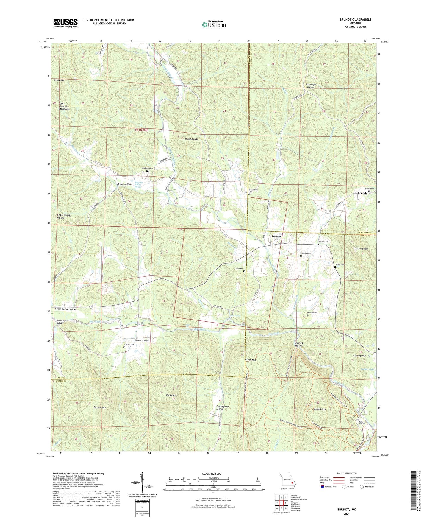
2021 topographic map quadrangle Brunot in the state of Missouri. Scale: 1:24000. Based on the newly updated USGS 7.5' US Topo map series, this map is in the following counties: Iron, Wayne, Madison. The map contains contour data, water features, and other items you are used to seeing on USGS maps, but also has updated roads and other features. This is the next generation of topographic maps. Printed on high-quality waterproof paper with UV fade-resistant inks.
Quads adjacent to this one:
West: Des Arc
Northwest: Glover
North: Des Arc NE
Northeast: Rock Pile Mountain
East: Coldwater
Southeast: Greenville
South: Patterson
Southwest: Piedmont
This map covers the same area as the classic USGS quad with code o37090c5.
Contains the following named places: Beulah, Beulah Church, Beulah School, Blue Spring, Brewington Cemetery, Brunot, Brunot Creek, Brunot School, Brushy Creek, Chilton Cemetery, Collins Lake Section 16 Dam, Crane Pond Creek, Crowley Hill, Cunningham Hollow, Des Arc Mountain, E W Graves Porphyry Quarry, Full Gospel Church, Glade Creek, Graves Mountain, Graves Mountain State Forest, Green Mountain, Henderson Hollow, Hickman Mountain, Hunter Cemetery, J.S. Benson Porphyry Quarry, King School, Lindsey Iron Bank, Lucy Cemetery, Mash Hollow, McCue Hollow, Meadows Cemetery, Mill Creek, Morris Cemetery, Mudlick Hollow, Mudlick Mountain, Nichols Cemetery, Patterson Branch, Roberts School, Rocky Mountain, Sam A Baker State Park, Schultz Lake Dam, Shut-Ins, Shy Dam, Shy Lake Dam, Sulphur Creek, Weeping Willow Spring, ZIP Code: 63636