MyTopo
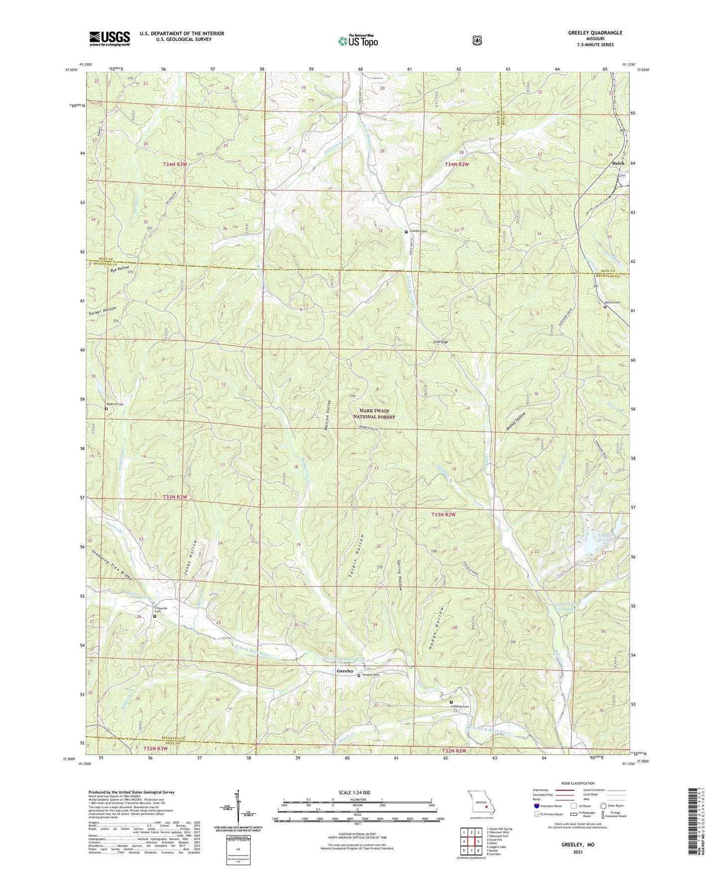
Greeley Missouri US Topo Map
Couldn't load pickup availability
Also explore the Greeley Forest Service Topo of this same quad for updated USFS data
2021 topographic map quadrangle Greeley in the state of Missouri. Scale: 1:24000. Based on the newly updated USGS 7.5' US Topo map series, this map is in the following counties: Reynolds, Dent, Iron. The map contains contour data, water features, and other items you are used to seeing on USGS maps, but also has updated roads and other features. This is the next generation of topographic maps. Printed on high-quality waterproof paper with UV fade-resistant inks.
Quads adjacent to this one:
West: Stone Hill
Northwest: Howes Mill Spring
North: Viburnum West
Northeast: Viburnum East
East: Oates
Southeast: Corridon
South: Bunker
Southwest: Loggers Lake
This map covers the same area as the classic USGS quad with code o37091e2.
Contains the following named places: Asher Creek, Barton Cemetery, Bills Creek School, Brushy Creek Mill Reservoir Dam, Brushy Creek Mine, Brushy Creek Mine Water Clarification Dam, Brushy Creek Mine Water Lake, Brushy Creek Tailings Dam, Bucksnort Fork, Buick, Buick Lookout Tower, Buick School, Callahan Cemetery, Camden Cemetery, Crossville Branch, Crossville Church, Elm Spring School, Greeley, Greeley Church, Greeley School, Henpeck Creek, Hodge Hollow, Jones Hollow, Lick Creek, Low Gap, McMurtrey Creek, McMurtrey School, Moore Branch, New Harmony Church, New Zion Church, Number 48 Lake, Parker Branch, Radford Branch, Radford Cemetery, Smalls Creek, Spring Branch, Spring Hollow, Stricklin Branch, Sugar Creek, Tarpit Hollow, Walnut Hollow, Warren Valley, ZIP Code: 65440