MyTopo
Lincoln NW Missouri US Topo Map
Couldn't load pickup availability
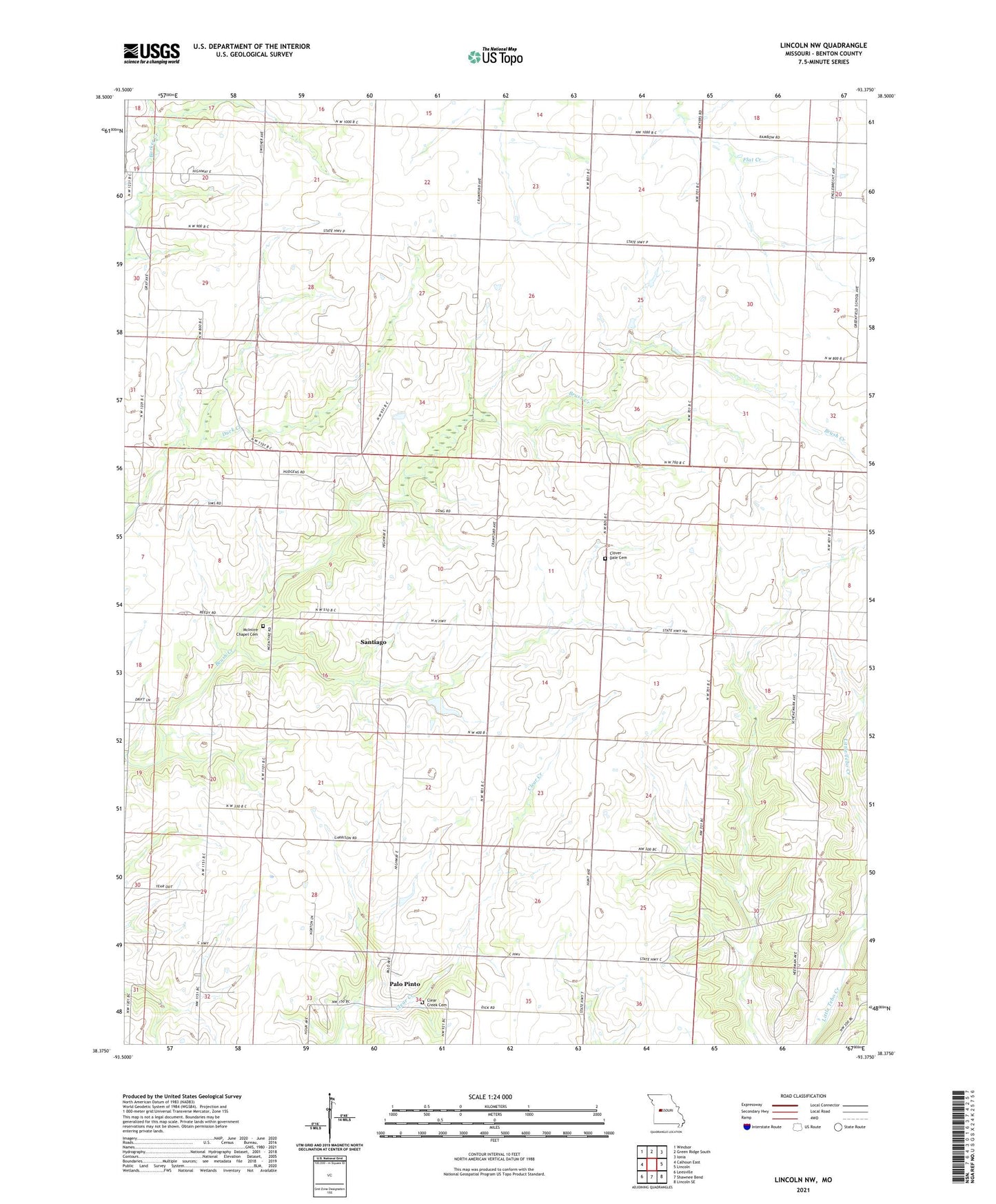
2021 topographic map quadrangle Lincoln NW in the state of Missouri. Scale: 1:24000. Based on the newly updated USGS 7.5' US Topo map series, this map is in the following counties: Benton. The map contains contour data, water features, and other items you are used to seeing on USGS maps, but also has updated roads and other features. This is the next generation of topographic maps. Printed on high-quality waterproof paper with UV fade-resistant inks.
Quads adjacent to this one:
West: Calhoun East
Northwest: Windsor
North: Green Ridge South
Northeast: Ionia
East: Lincoln
Southeast: Lincoln SE
South: Shawnee Bend
Southwest: Leesville
This map covers the same area as the classic USGS quad with code o38093d4.
Contains the following named places: Byler Branch, Clear Creek Cemetery, Clear Creek Church, Clover Dale Cemetery, Fairfield School, Greenfield School, Harmony Church, McIntire Chapel Cemetery, Palo Pinto, Prairie View School, Rocky Dale School, Santiago, Santiago School, Township of White