MyTopo
Lincoln Missouri US Topo Map
Couldn't load pickup availability
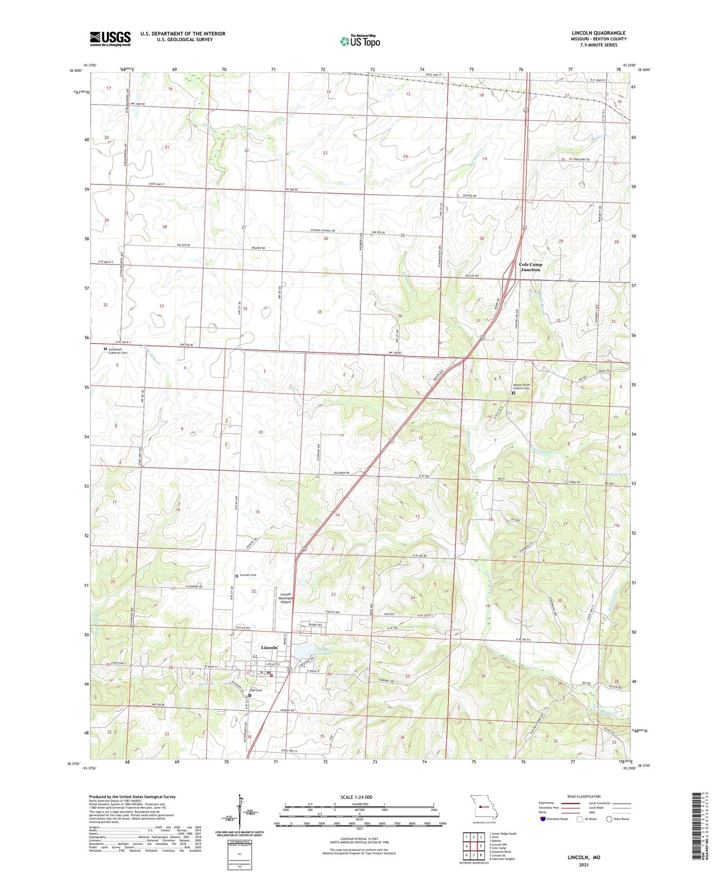
2021 topographic map quadrangle Lincoln in the state of Missouri. Scale: 1:24000. Based on the newly updated USGS 7.5' US Topo map series, this map is in the following counties: Benton. The map contains contour data, water features, and other items you are used to seeing on USGS maps, but also has updated roads and other features. This is the next generation of topographic maps. Printed on high-quality waterproof paper with UV fade-resistant inks.
Quads adjacent to this one:
West: Lincoln NW
Northwest: Green Ridge South
North: Ionia
Northeast: Bahner
East: Cole Camp
Southeast: Lakeview Heights
South: Lincoln SE
Southwest: Shawnee Bend
This map covers the same area as the classic USGS quad with code o38093d3.
Contains the following named places: Bauer Branch, Carman Creek, City of Lincoln, Cole Camp Junction, Fordney School, Golden School, Hutsler School, Immanuel Church, Immanuel Lutheran Cemetery, Karr Lake Dam, Lincoln, Lincoln Cemetery, Lincoln Community Fire District Fire Station, Lincoln Municipal Airport, Lincoln Post Office, McMurdo School, Mount Olivet Church, Mount Olivet Church Cemetery, Pierce School, Plain View School, Raymond, Rocky Ridge School, Timber Line Lake, Timber Line Lake Dam, Williams Creek, Zion Cemetery, Zion Church