MyTopo
Competition Missouri US Topo Map
Couldn't load pickup availability
Also explore the Competition Forest Service Topo of this same quad for updated USFS data
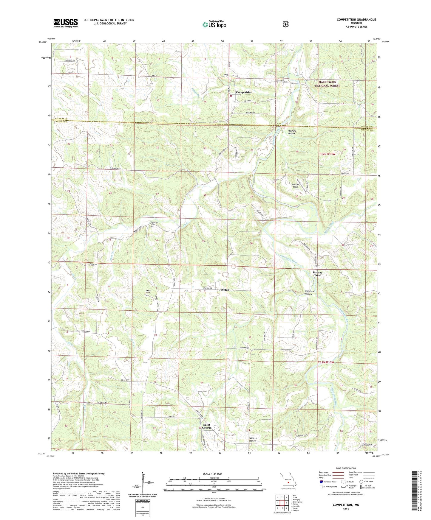
2021 topographic map quadrangle Competition in the state of Missouri. Scale: 1:24000. Based on the newly updated USGS 7.5' US Topo map series, this map is in the following counties: Wright, Laclede. The map contains contour data, water features, and other items you are used to seeing on USGS maps, but also has updated roads and other features. This is the next generation of topographic maps. Printed on high-quality waterproof paper with UV fade-resistant inks.
Quads adjacent to this one:
West: Grovespring
Northwest: Russ
North: Drew
Northeast: Winnipeg
East: Manes
Southeast: Dawson
South: Fuson
Southwest: Hartville
This map covers the same area as the classic USGS quad with code o37092d4.
Contains the following named places: Beaver Creek, Burney Ford, Cantrell School, Cheerfull Hill School, Claxton Church, Coldwater Church, Coldwater School, Competition, Competition Volunteer Fire Department Station 2, Dorris Cemetery, Elk Creek, Elk Creek Church, Elk Creek School, Emerson Cemetery, Evening Shade Church, Evening Shade School, Fincher School, Glenwood School, Happy Hill Church, Hillhouse Hollow, Jerktail, Liberty Church, McBride Church, New Home Church, Saint George, Scotts Branch, Snouffer Field, Sutton Branch, Township of Elk Creek, Webb Creek, Wichita Hollow, Wilber Allen Memorial State Wildlife Area