MyTopo
Guilford Missouri US Topo Map
Couldn't load pickup availability
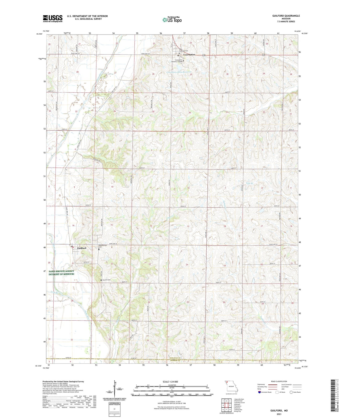
2021 topographic map quadrangle Guilford in the state of Missouri. Scale: 1:24000. Based on the newly updated USGS 7.5' US Topo map series, this map is in the following counties: Nodaway, Andrew. The map contains contour data, water features, and other items you are used to seeing on USGS maps, but also has updated roads and other features. This is the next generation of topographic maps. Printed on high-quality waterproof paper with UV fade-resistant inks.
Quads adjacent to this one:
West: Barnard
Northwest: Maryville East
North: Ravenwood
Northeast: Alanthus Grove
East: Stanberry
Southeast: King City
South: Whitesville
Southwest: Bolckow
Contains the following named places: Barnard Fire Protection District Station 2, Bethel Church, Conception, Conception Abbey Dam, Conception Abbey Reservoir, Conception Census Designated Place, Conception College, Conception Post Office, Green School, Groves Cemetery, Guilford, Guilford Post Office, Lincoln School, Long Branch, McCann School, Monastery, Pleasant View School, Saint Marys School, South Nodaway Elementary School, Town of Guilford, Township of Washington, Washington School, Weathermon Cemetery, Whiteford School, Whiteoak School, ZIP Codes: 64433, 64457