MyTopo
Winston Missouri US Topo Map
Couldn't load pickup availability
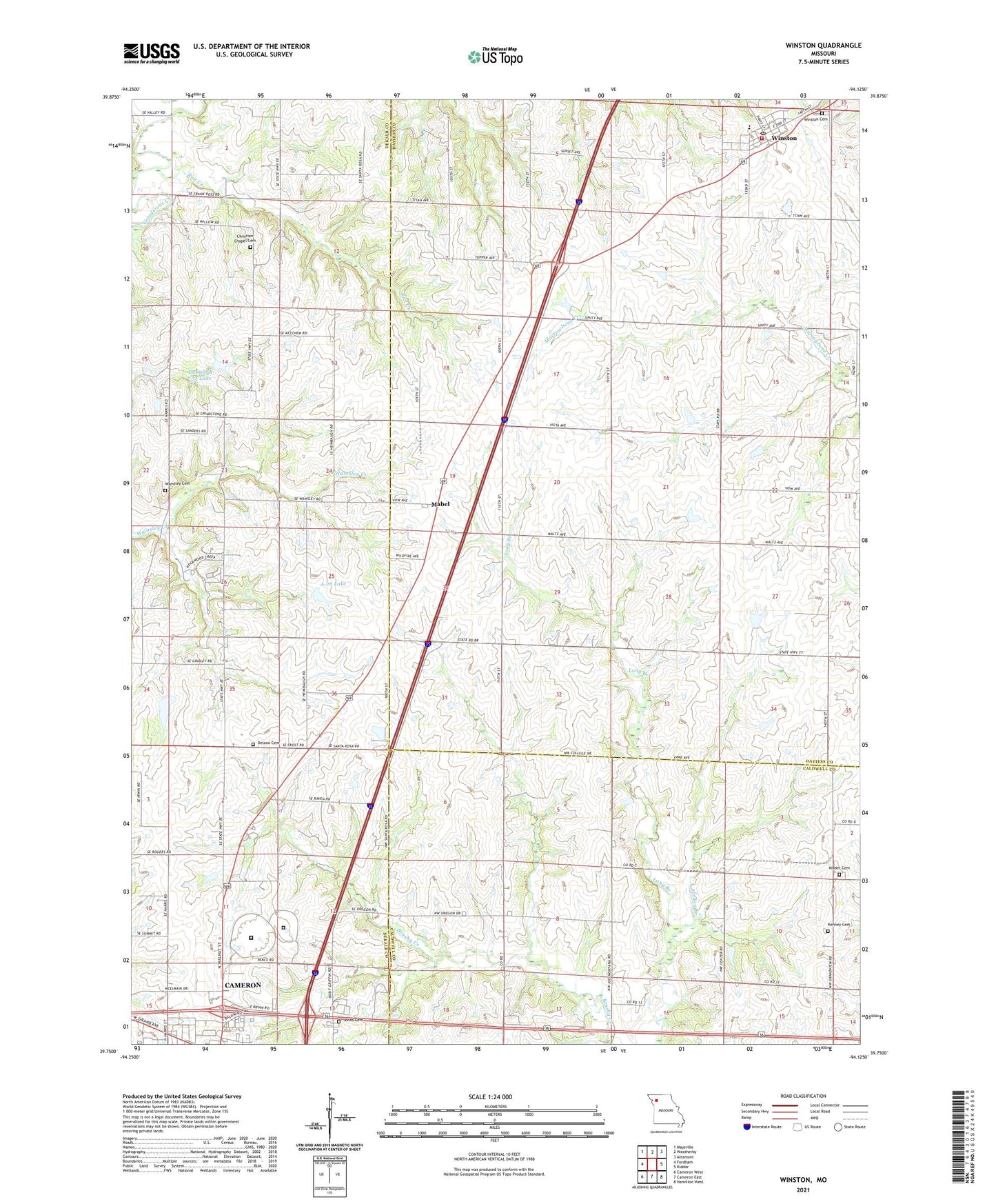
2021 topographic map quadrangle Winston in the state of Missouri. Scale: 1:24000. Based on the newly updated USGS 7.5' US Topo map series, this map is in the following counties: Daviess, DeKalb, Caldwell. The map contains contour data, water features, and other items you are used to seeing on USGS maps, but also has updated roads and other features. This is the next generation of topographic maps. Printed on high-quality waterproof paper with UV fade-resistant inks.
Quads adjacent to this one:
West: Fordham
Northwest: Maysville
North: Weatherby
Northeast: Altamont
East: Kidder
Southeast: Hamilton West
South: Cameron East
Southwest: Cameron West
This map covers the same area as the classic USGS quad with code o39094g2.
Contains the following named places: A-26 Lake, Christian Chapel Cemetery, Crossroads Correctional Center, DeKalb A-33 Lake, Delano Cemetery, Eureka School, Finkle Lake Dam, Four County Plaza, Grindstone-Lost-Muddy Creek Watershed Dam A-26, Grindstone-Lost-Muddy Creek Watershed Dam A-33, Harris School, Island Number 10 School, Jones Cemetery, Jordan Branch, Karr Lake Dam, Kenney Cemetery, Kidder - Altamont - Winston Fire Protection District Winston, Kidder Cemetery, Kinney School, Lone Cottage School, Mabel, Mount Pleasant School, Prairie Gem School, Ray School, Rice Creek, Rogers School, Severling Lake Dam, Taylor Mills School, Township of Colfax, Village of Winston, Wamsley Cemetery, Wamsley Church, Wamsley School, Western Missouri Correctional Center, Winston, Winston Cemetery, Winston Elementary School, Winston High School, Winston Post Office, Wood School, ZIP Code: 64689