MyTopo
Hannibal East Missouri US Topo Map
Couldn't load pickup availability
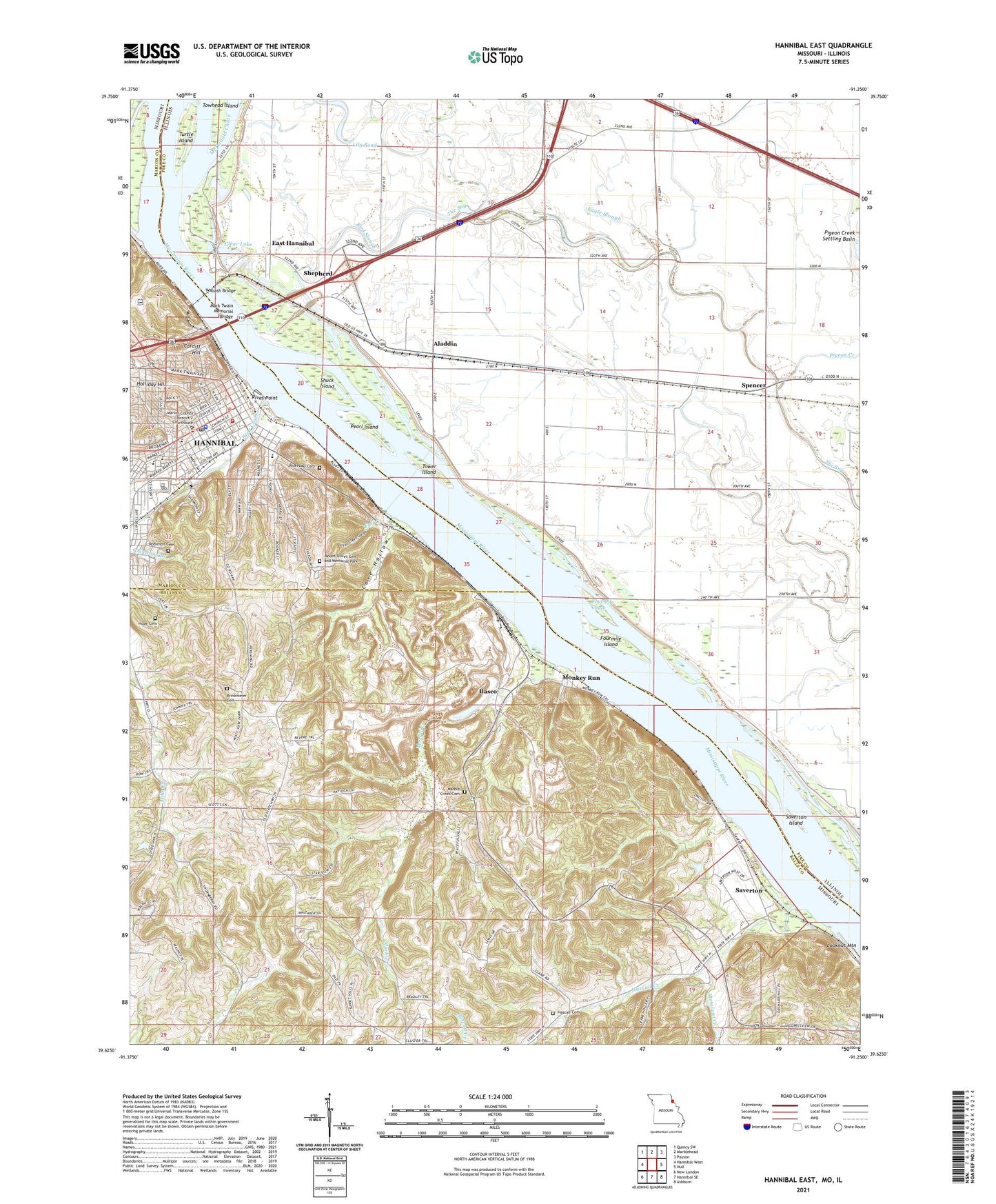
2021 topographic map quadrangle Hannibal East in the states of Missouri, Illinois. Scale: 1:24000. Based on the newly updated USGS 7.5' US Topo map series, this map is in the following counties: Ralls, Pike, Marion. The map contains contour data, water features, and other items you are used to seeing on USGS maps, but also has updated roads and other features. This is the next generation of topographic maps. Printed on high-quality waterproof paper with UV fade-resistant inks.
Quads adjacent to this one:
West: Hannibal West
Northwest: Quincy SW
North: Marblehead
Northeast: Payson
East: Hull
Southeast: Ashburn
South: Hannibal SE
Southwest: New London
This map covers the same area as the classic USGS quad with code o39091f3.
Contains the following named places: Aladdin, Antioch Chapel Baptist Church, Bear Creek, Bird Slough, Bird Slough School, Brinkmeier Cemetery, Broadway Wharf, Camp Oko-Tipi, Cardiff Hill, Cave City, Cave Hollow, Centennial Memorial Lighthouse, Central Park, Central School, Chenale Ecarte Club, Clear Lake, Clemens, Clemens Field, Eagle Slough, Eagle Slough School, East Hannibal, Fall Creek, Fall Creek Gorge, Field School, Fourmile Chute, Fourmile Island, Gilbert Landing, Hannibal, Hannibal Fire Department Station 1, Hannibal Police Department, Hannibal Post Office, Hascall Cemetery, Hascall Creek, Holliday Hill, Hope Cemetery, Ilasco, Inspiration Point, Lily Pond, Lookout Mountain, Malaruni Creek, Marble Creek, Marble Creek Cemetery, Marble Creek School, Marion County Sheriff's Office, Mark Twain Boyhood Home, Mark Twain Memorial Bridge, Mark Twain Region, McDonald Chute, Mills Creek School, Monkey Run, Mount Olivet Cemetery and Memorial Park, Mount Olivet Memorial Park, Nippers Park, Old Smith School, Pearl Island, Pettibone School, Pigeon Creek, Pool 22, River Point, Riverside, Riverside Cemetery, Riverview Park, Robinson Cemetery, Rouse School, Running Slough, Running Slough School, Saint John School, Saverton, Saverton Census Designated Place, Saverton Island, Shepherd, Shuck Island, Spencer, Tower Island, Towhead Island, Township of Levee, Township of Mason, Treats Dam, Turtle Island, Wabash Bridge, Wild Cat Corner, Ziegler Island, ZIP Code: 63467