MyTopo
Payson Illinois US Topo Map
Couldn't load pickup availability
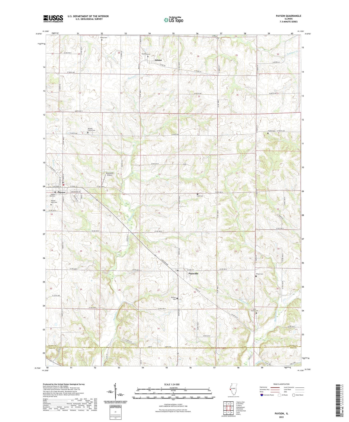
2024 topographic map quadrangle Payson in the state of Illinois. Scale: 1:24000. Based on the newly updated USGS 7.5' US Topo map series, this map is in the following counties: Adams, Pike. The map contains contour data, water features, and other items you are used to seeing on USGS maps, but also has updated roads and other features. This is the next generation of topographic maps. Printed on high-quality waterproof paper with UV fade-resistant inks.
Quads adjacent to this one:
West: Marblehead
Northwest: Quincy East
North: Columbus
Northeast: Liberty
East: Richfield
Southeast: Barry
South: Hull
Southwest: Hannibal East
This map covers the same area as the classic USGS quad with code o39091g2.
Contains the following named places: Adams, Adams Census Designated Place, Anderson Branch, California School, Cook Cemetery, Cooke School, Franks Cemetery, Greencastle School, Krutmeier Airport, Lock Family Cemetery, Meyers Dairy Farm, Newton Cemetery, Nichols Family Cemetery, Oakwood School, Oregon School, Payson, Payson - Fall Creek Fire Protection District 1, Payson Congregational Church, Payson New Cemetery, Payson Old Cemetery, Payson Post Office, Plainville, Plainville Post Office, Rice School, Schroth School, Seymour Elementary School, Shiloh Cemetery, Sodom School, Stewart Cemetery, Tandy Cemetery, Tandy School, Township of Payson, Union School, Village of Payson, Village of Plainville, Wagy School, Whitcomb School, ZIP Code: 62365