MyTopo
Hawk Point Missouri US Topo Map
Couldn't load pickup availability
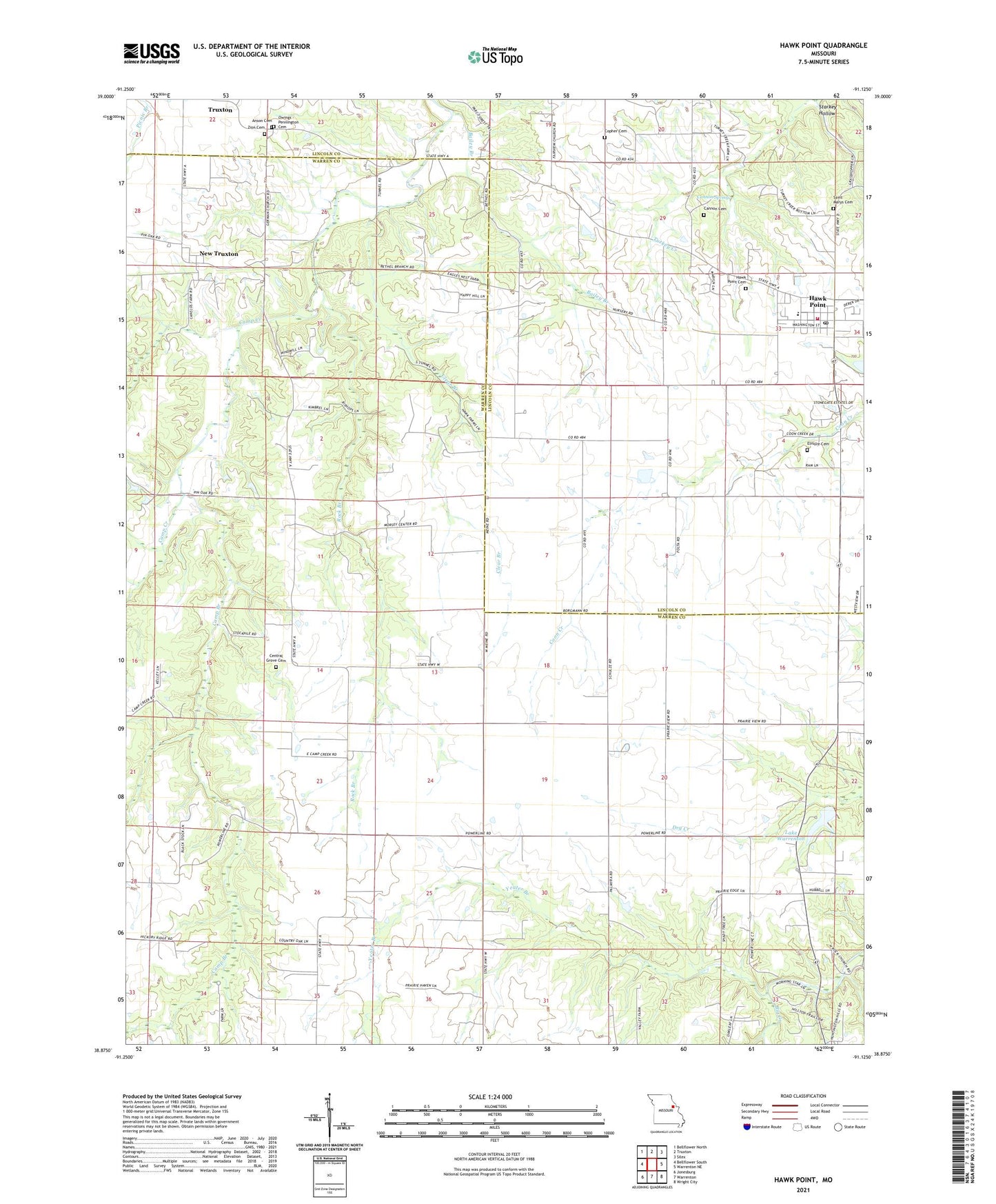
2021 topographic map quadrangle Hawk Point in the state of Missouri. Scale: 1:24000. Based on the newly updated USGS 7.5' US Topo map series, this map is in the following counties: Warren, Lincoln. The map contains contour data, water features, and other items you are used to seeing on USGS maps, but also has updated roads and other features. This is the next generation of topographic maps. Printed on high-quality waterproof paper with UV fade-resistant inks.
Quads adjacent to this one:
West: Bellflower South
Northwest: Bellflower North
North: Truxton
Northeast: Silex
East: Warrenton NE
Southeast: Wright City
South: Warrenton
Southwest: Jonesburg
Contains the following named places: Anson Cemetery, Bailey Branch, Camp Branch, Cannon Cemetery, Cannon Spring, Central Grove Cemetery, Central Grove Church, City of Hawk Point, Clear Branch, Copher Cemetery, Copher School, Elmore Cemetery, Elmore School, Happy Hill School, Harper School, Hawk Point, Hawk Point Cemetery, Hawk Point Elementary School, Hawk Point Fire Protection District, Hawk Point Post Office, Jones School, Kelly School, Lake Warrenton, Lake Warrenton Dam, Morsey, Morsey Community Center, New Truxton, New Truxton School, Owings - Pennington Cemetery, Prairieview, Rock Branch, Saint Mary Parish, Saint Marys Cemetery, Starkey Hollow, Township of Camp Branch, Weeks Community Center, Yeater Branch, Yeater Prairie, Zion Cemetery, Zion Church, ZIP Code: 63349