MyTopo
Hayti Heights Missouri US Topo Map
Couldn't load pickup availability
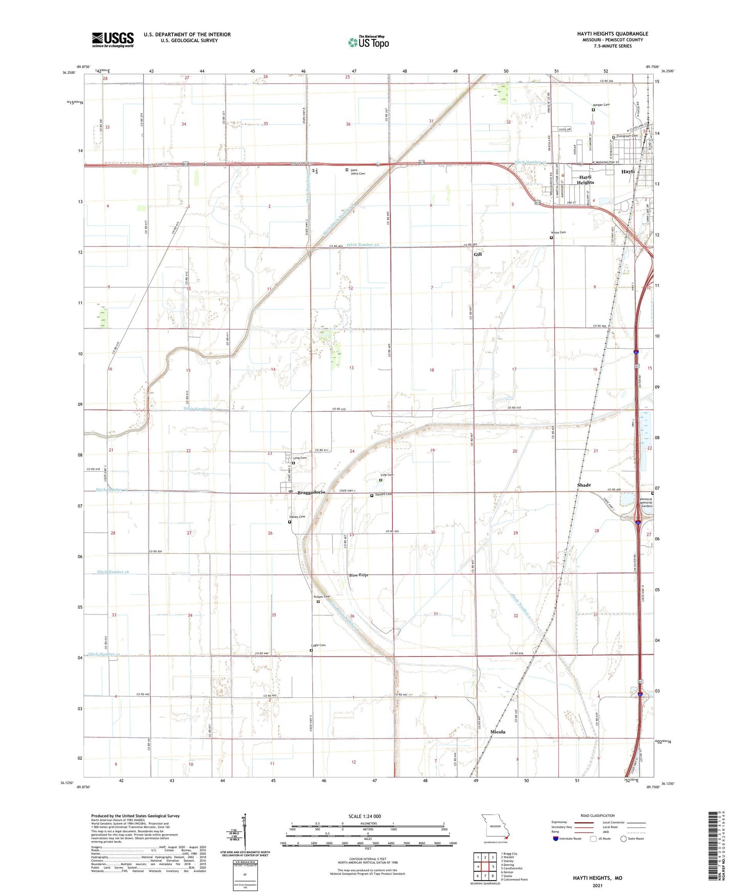
2021 topographic map quadrangle Hayti Heights in the state of Missouri. Scale: 1:24000. Based on the newly updated USGS 7.5' US Topo map series, this map is in the following counties: Pemiscot. The map contains contour data, water features, and other items you are used to seeing on USGS maps, but also has updated roads and other features. This is the next generation of topographic maps. Printed on high-quality waterproof paper with UV fade-resistant inks.
Quads adjacent to this one:
West: Deering
Northwest: Bragg City
North: Wardell
Northeast: Stanley
East: Caruthersville
Southeast: Cottonwood Point
South: Steele
Southwest: Denton
Contains the following named places: Blazer, Blow Ridge, Braggadocio, Braggadocio Post Office, Braggadocio School, Cagle Cemetery, Canaday Switch School, Canady Switch, City of Hayti Heights, Culp Cemetery, Darnell Cemetery, Ditch Number 12, Ditch Number 15, Ditch Number 18, Ditch Number 20, Ditch Number 21, Ditch Number 4, Duland, Elk Chute, Erwin, Evergreen Cemetery, Faris, Gill, Grassy Bayou, Hatley Cemetery, Hayti Heights, Hayti Heights Fire Department, Henchley, Kauffman, Littles, Long Cemetery, Main Ditch Number 6, Main Ditch Number 8, Micola, Morgan Cemetery, Pemiscot County, Pemiscot County Farm, Pemiscot County Special School, Pemiscot County Vocational School, Pemiscot Memorial Gardens, Pullam Cemetery, Saint Johns Cemetery, Shade, South School, Spear School, Strother, Township of Hayti, Vicksburg, Vicksburg Church, Vicksburg School, White Cemetery, ZIP Code: 63826