MyTopo
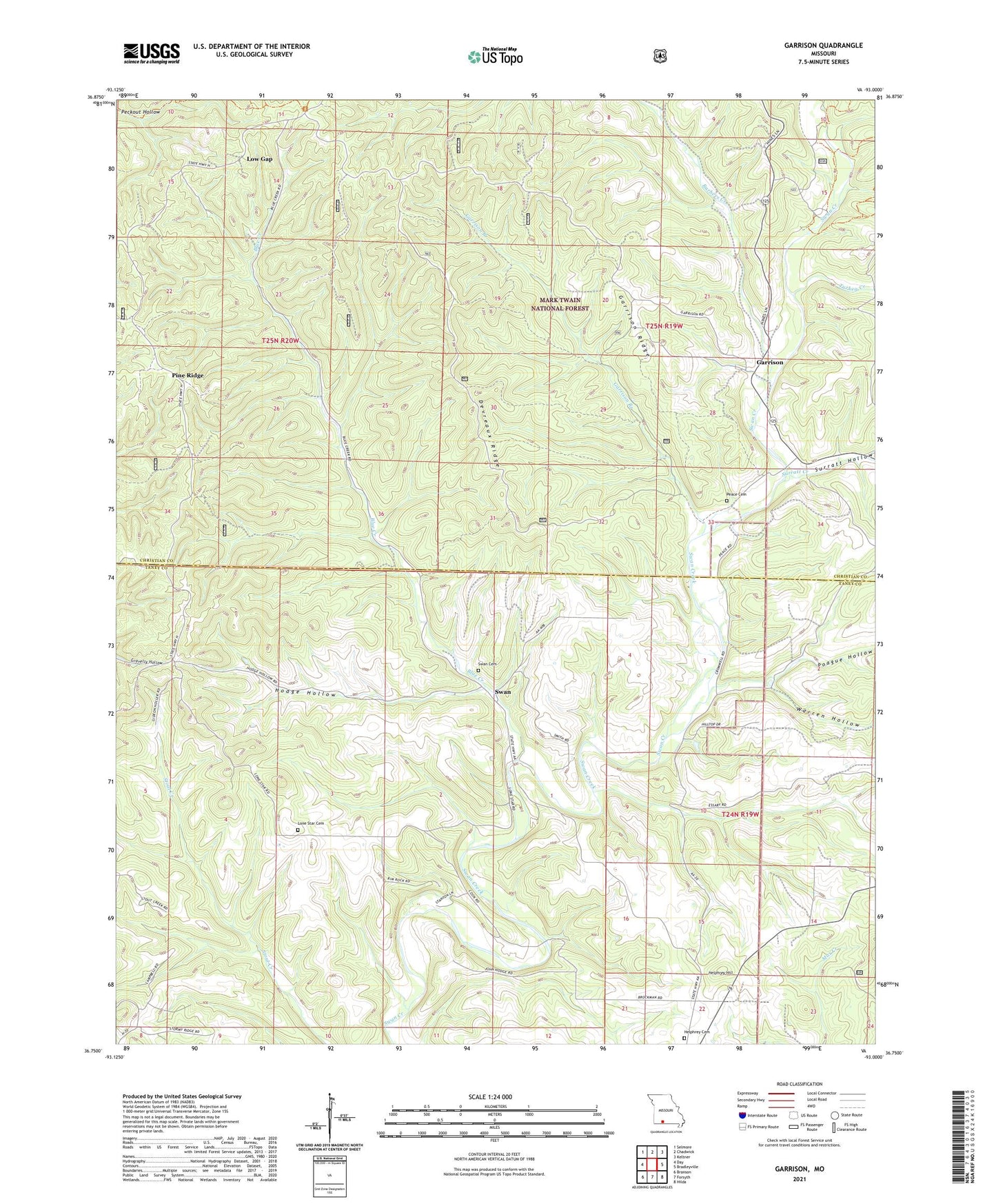
Garrison Missouri US Topo Map
Couldn't load pickup availability
Also explore the Garrison Forest Service Topo of this same quad for updated USFS data
2021 topographic map quadrangle Garrison in the state of Missouri. Scale: 1:24000. Based on the newly updated USGS 7.5' US Topo map series, this map is in the following counties: Christian, Taney. The map contains contour data, water features, and other items you are used to seeing on USGS maps, but also has updated roads and other features. This is the next generation of topographic maps. Printed on high-quality waterproof paper with UV fade-resistant inks.
Quads adjacent to this one:
West: Day
Northwest: Selmore
North: Chadwick
Northeast: Keltner
East: Bradleyville
Southeast: Hilda
South: Forsyth
Southwest: Branson
This map covers the same area as the classic USGS quad with code o36093g1.
Contains the following named places: Ameera, Barbers Creek, Blue Creek, Devreaux Ridge, Garrison, Garrison Branch, Garrison Ridge, Garrison School, Helphrey Cemetery, Helphrey Hill, Helphry School, Hodge Hollow, Lone Star Church, Low Gap, Middleton Church, Oak Wood Church, Oakwood School, Peace Cemetery, Pine Ridge, Pine Ridge Church, Pine Ridge School, Poague Hollow, Saunders, Sto, Surratt Creek, Surratt Hollow, Swan, Swan Cemetery, Township of Garrison, Township of South Linn, Turkey Creek, Warren Hollow, ZIP Codes: 65657, 65759