MyTopo
Hurdland Missouri US Topo Map
Couldn't load pickup availability
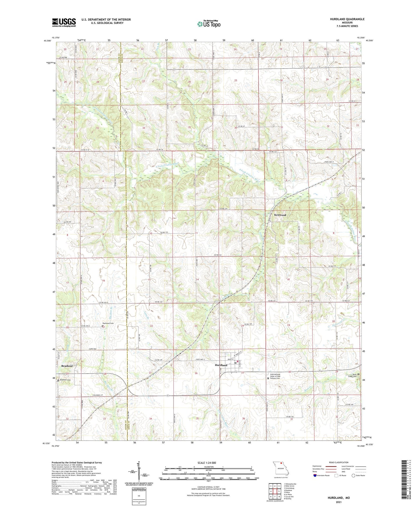
2021 topographic map quadrangle Hurdland in the state of Missouri. Scale: 1:24000. Based on the newly updated USGS 7.5' US Topo map series, this map is in the following counties: Knox, Adair. The map contains contour data, water features, and other items you are used to seeing on USGS maps, but also has updated roads and other features. This is the next generation of topographic maps. Printed on high-quality waterproof paper with UV fade-resistant inks.
Quads adjacent to this one:
West: Brashear
Northwest: Willmathsville
North: Bible Grove
Northeast: Greensburg
East: Edina
Southeast: Novelty
South: Locust Hill
Southwest: La Plata
Contains the following named places: Baker School, Black School, Brashear Cemetery, City of Hurdland, Colonial Knoll Lake, Delaney School, Fox School, Hunziker Airport, Hurdland, Hurdland Post Office, Hurdland Station, Hurdland Volunteer Fire Department, International Order of Odd Fellows Cemetery, James Lake, James Lake Dam, Kenwood, Liberty Grove School, Long Branch, Nick Branch, Parsons Lake, Parsons Lake Dam, Paultown, Paultown Cemetery, Paultown School, Pleasant Hill School, Rock Creek Branch Dam, Rock Creek Cemetery, Rock Creek Church, Rock Creek School, Taylor Lake, Taylor Lake Dam, Township of Lyon, ZIP Code: 63547