MyTopo
Middle Grove Missouri US Topo Map
Couldn't load pickup availability
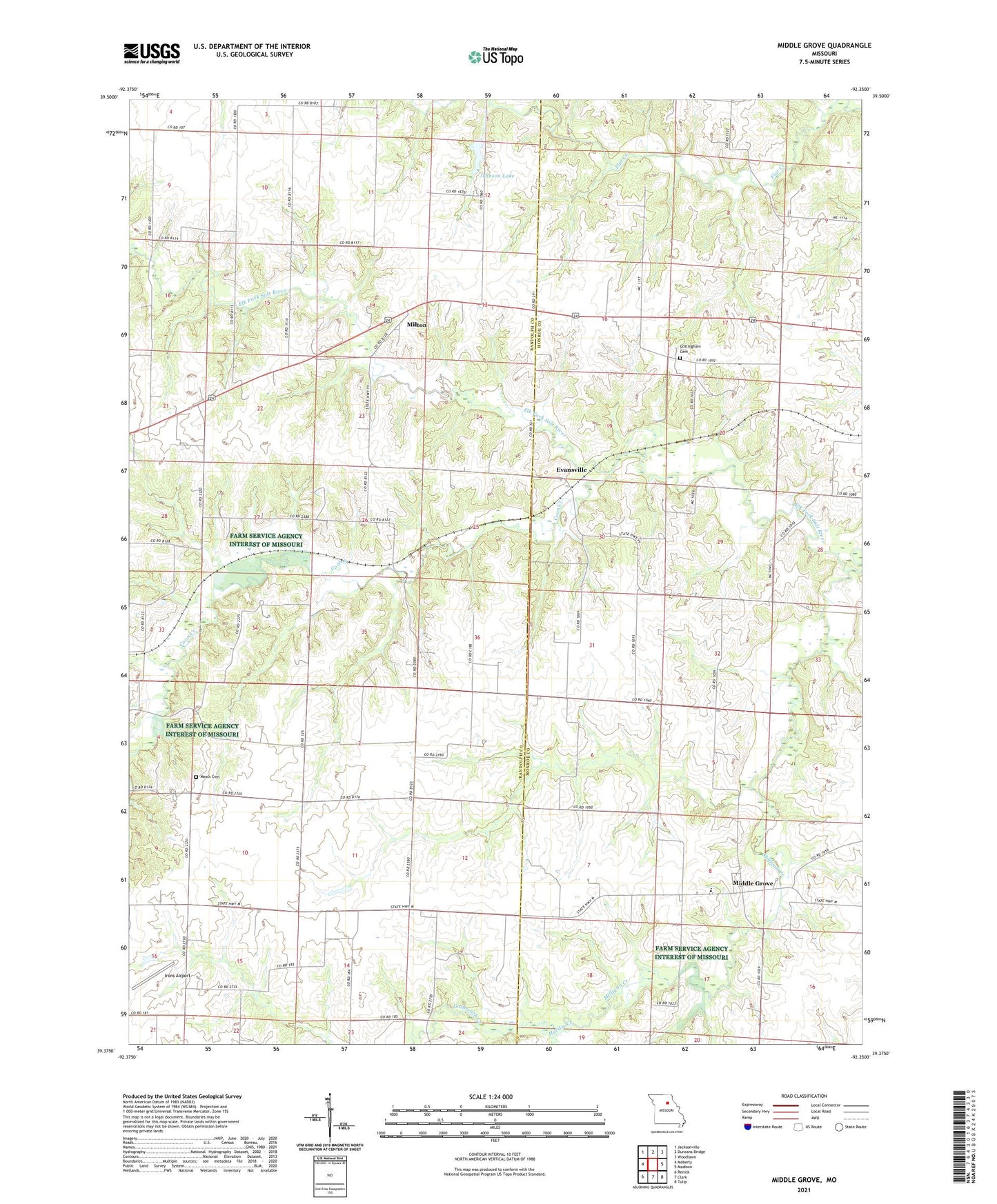
2021 topographic map quadrangle Middle Grove in the state of Missouri. Scale: 1:24000. Based on the newly updated USGS 7.5' US Topo map series, this map is in the following counties: Randolph, Monroe. The map contains contour data, water features, and other items you are used to seeing on USGS maps, but also has updated roads and other features. This is the next generation of topographic maps. Printed on high-quality waterproof paper with UV fade-resistant inks.
Quads adjacent to this one:
West: Moberly
Northwest: Jacksonville
North: Duncans Bridge
Northeast: Woodlawn
East: Madison
Southeast: Tulip
South: Clark
Southwest: Renick
This map covers the same area as the classic USGS quad with code o39092d3.
Contains the following named places: Anderson Lake, Anderson Lake Dam, Antioch Church, Brooks School, Brown Lake Dam, Chandler School, Coon Creek, Cottingham Cemetery, Enon Church, Evansville, Galbreath Creek, Hardin Creek, Irons Airport, Johnson Lake, Johnson Lake Dam, Mallory Lake, Mallory Lake Dam, McCowan Dam, Meals Cemetery, Middle Grove, Middle Grove Census Designated Place, Milligan Creek, Milton, Milton School, Number Six School, Salem Christian Church, Salem School, Scott School, Stony Point School, Township of Union