MyTopo
Jamesport Missouri US Topo Map
Couldn't load pickup availability
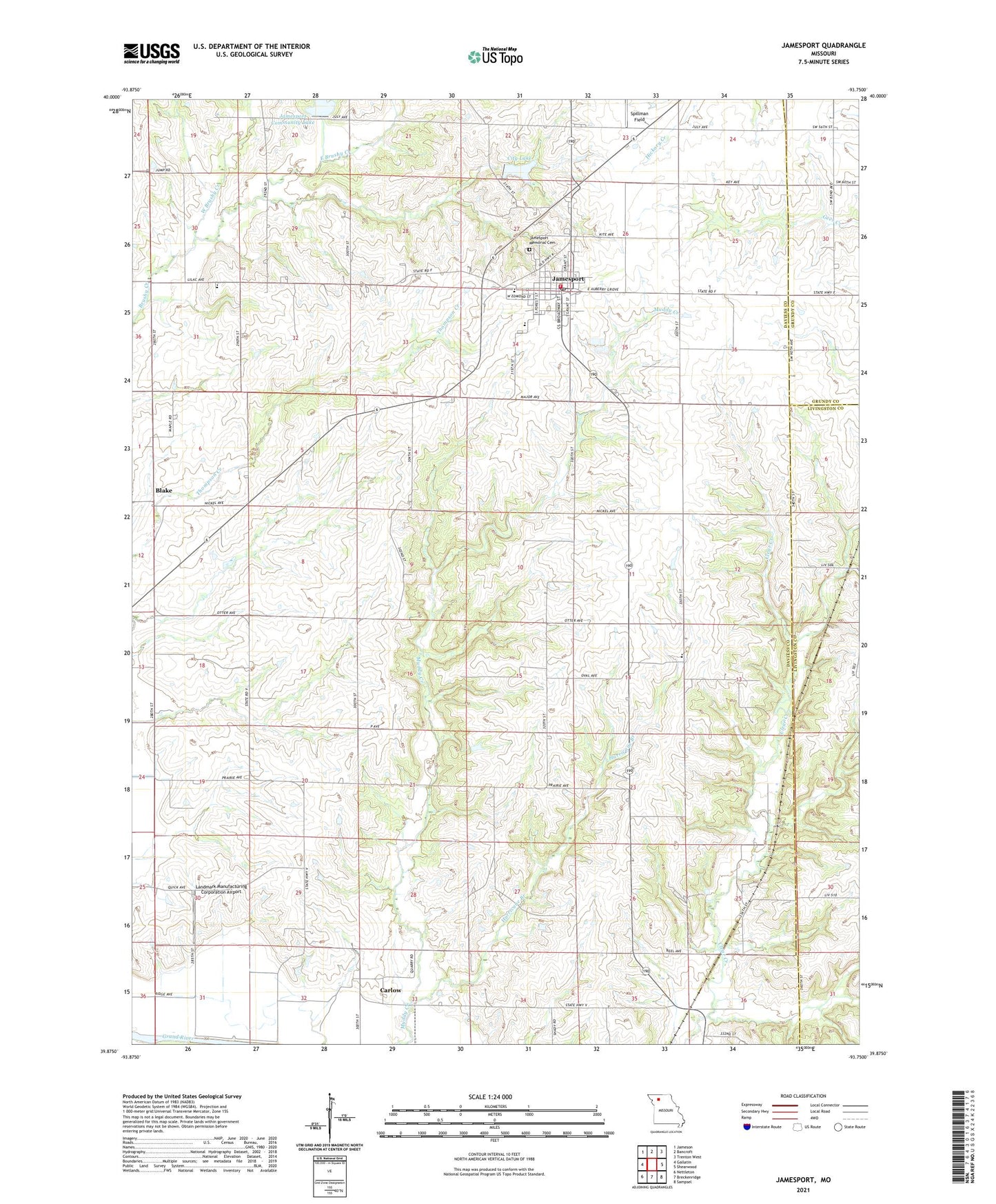
2021 topographic map quadrangle Jamesport in the state of Missouri. Scale: 1:24000. Based on the newly updated USGS 7.5' US Topo map series, this map is in the following counties: Daviess, Livingston, Grundy. The map contains contour data, water features, and other items you are used to seeing on USGS maps, but also has updated roads and other features. This is the next generation of topographic maps. Printed on high-quality waterproof paper with UV fade-resistant inks.
Quads adjacent to this one:
West: Gallatin
Northwest: Jameson
North: Bancroft
Northeast: Trenton West
East: Shearwood
Southeast: Sampsel
South: Breckenridge
Southwest: Nettleton
This map covers the same area as the classic USGS quad with code o39093h7.
Contains the following named places: Arnold School, Blake, Blake School, Brown School, Carlow, City Lake, City of Jamesport, Clear Creek Church, Clear Creek School, East Brushy Creek, Froman Lake Dam, Hurricane Branch, Jamesport, Jamesport City Dam, Jamesport Community Lake, Jamesport Lake Dam, Jamesport Memorial Cemetery, Jamesport Post Office, Jamesport Volunteer Fire Department, Landmark Manufacturing Corporation Airport, McClung School, Miller School, Mount Olive Church, Mount Zion Church, Prairie Valley Church, Spillman Field, Township of Jackson, Tri - County Elementary School, Tri - County High School, West Brushy Creek, ZIP Code: 64648