MyTopo
Jerico Springs Missouri US Topo Map
Couldn't load pickup availability
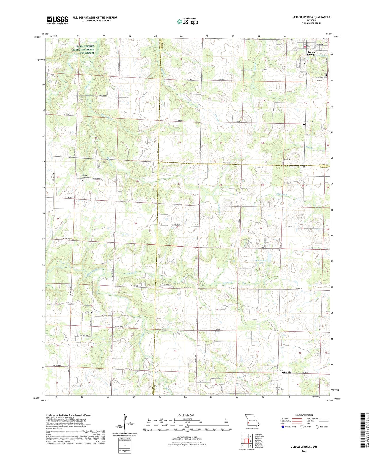
2021 topographic map quadrangle Jerico Springs in the state of Missouri. Scale: 1:24000. Based on the newly updated USGS 7.5' US Topo map series, this map is in the following counties: Dade, Barton, Cedar. The map contains contour data, water features, and other items you are used to seeing on USGS maps, but also has updated roads and other features. This is the next generation of topographic maps. Printed on high-quality waterproof paper with UV fade-resistant inks.
Quads adjacent to this one:
West: Milford
Northwest: Bellamy
North: Montevallo
Northeast: Wagoner
East: Cedarville
Southeast: Lockwood
South: Golden City
Southwest: Kenoma
Contains the following named places: Anna - Edna Cemetery, Banner School, Bethlehem Church, Big George Branch, Campbell Lake Dam, Chaney Branch, Don Henley Lake, English School, Flory, German Cemetery, Ginger Hill School, Greenfield Cemetery, Greer School, Harmony Church, Jerico Springs, Jerico Springs Fire Department, Jerico Springs Post Office, Maple Grove Church, Mitchell School, Newport, Newport School, Number 706 Dam, Paragon School, Patton Branch, Pleasant View School, Rockdale School, Round Prairie Cemetery, Round Prairie School, Star School, Stony Point Church, Stony Point School, Sunshine School, Sylvania, Sylvania School, Township of Cedar, Township of Milford, Township of Newport, Village of Jerico Springs, West Independence, White Oak Branch, Winningham Lake Dam, ZIP Code: 64756