MyTopo
Bellamy Missouri US Topo Map
Couldn't load pickup availability
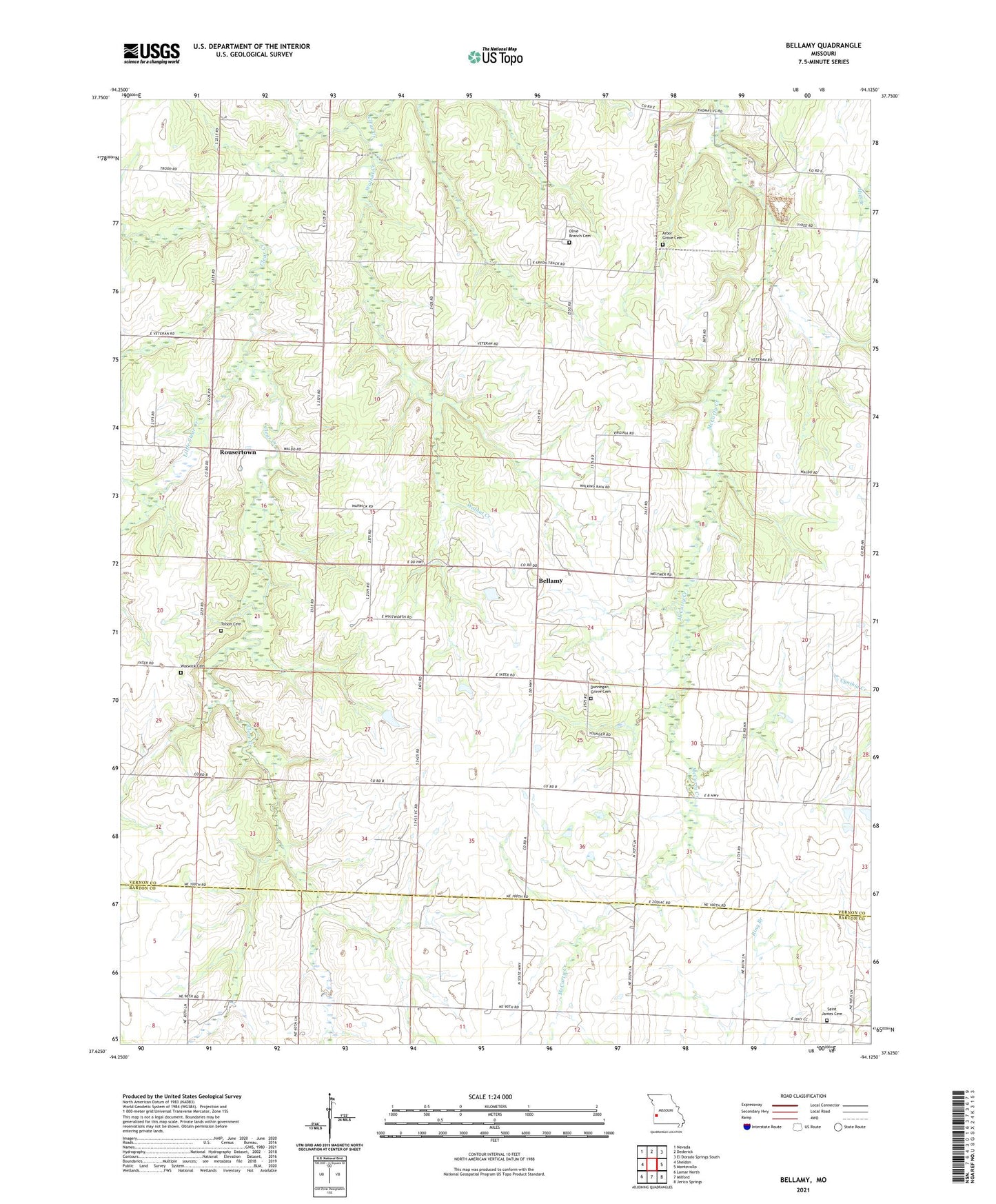
2021 topographic map quadrangle Bellamy in the state of Missouri. Scale: 1:24000. Based on the newly updated USGS 7.5' US Topo map series, this map is in the following counties: Vernon, Barton. The map contains contour data, water features, and other items you are used to seeing on USGS maps, but also has updated roads and other features. This is the next generation of topographic maps. Printed on high-quality waterproof paper with UV fade-resistant inks.
Quads adjacent to this one:
West: Sheldon
Northwest: Nevada
North: Dederick
Northeast: El Dorado Springs South
East: Montevallo
Southeast: Jerico Springs
South: Milford
Southwest: Lamar North
This map covers the same area as the classic USGS quad with code o37094f2.
Contains the following named places: Arbor Grove Cemetery, Bellamy, Bellamy School, Blanchards Lake, Claflin Lake Dam, Dunnegan Grove Cemetery, Dunnegan Grove Church, Little Clear Creek, New Harmony School, Olive Branch Cemetery, Olive Branch Church, Phillips School, Pleasant Plain School, Pottorf Lake Dam, Rousertown, Saint James Cemetery, Saint James Church, Science Hill School, Stone Front School, Tolson Cemetery, Township of Dover, Walnut Creek, Warwick Cemetery, Warwick School, Wise, ZIP Codes: 64767, 64784