MyTopo
Kilwinning Missouri US Topo Map
Couldn't load pickup availability
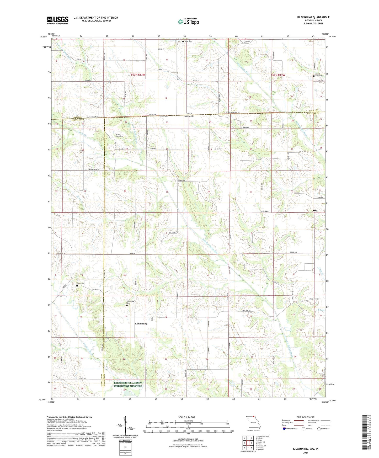
2021 topographic map quadrangle Kilwinning in the states of Missouri, Iowa. Scale: 1:24000. Based on the newly updated USGS 7.5' US Topo map series, this map is in the following counties: Scotland, Davis, Schuyler. The map contains contour data, water features, and other items you are used to seeing on USGS maps, but also has updated roads and other features. This is the next generation of topographic maps. Printed on high-quality waterproof paper with UV fade-resistant inks.
Quads adjacent to this one:
West: Bunker Hill
Northwest: Bloomfield South
North: Pulaski
Northeast: Milton
East: Brock
Southeast: Memphis
South: Downing
Southwest: Downing NW
Contains the following named places: Barker Cemetery, Bourn School, Brush Creek, Carter Creek, Cone Cemetery, Cox School, Four Corners Community Hall, Hitt, Kilwinning, Kilwinning Cemetery, Lister Cemetery, North Barker School, Pleasant Hill Community Hall, Pleasant Hill United Presbyterian Church, Richland Baptist Church, Robinson School, Round Grove Cemetery, Sacred Heart Cemetery, Spees School, Swanston School, Township of Miller, Wanetta Corner