MyTopo
Lathrop Missouri US Topo Map
Couldn't load pickup availability
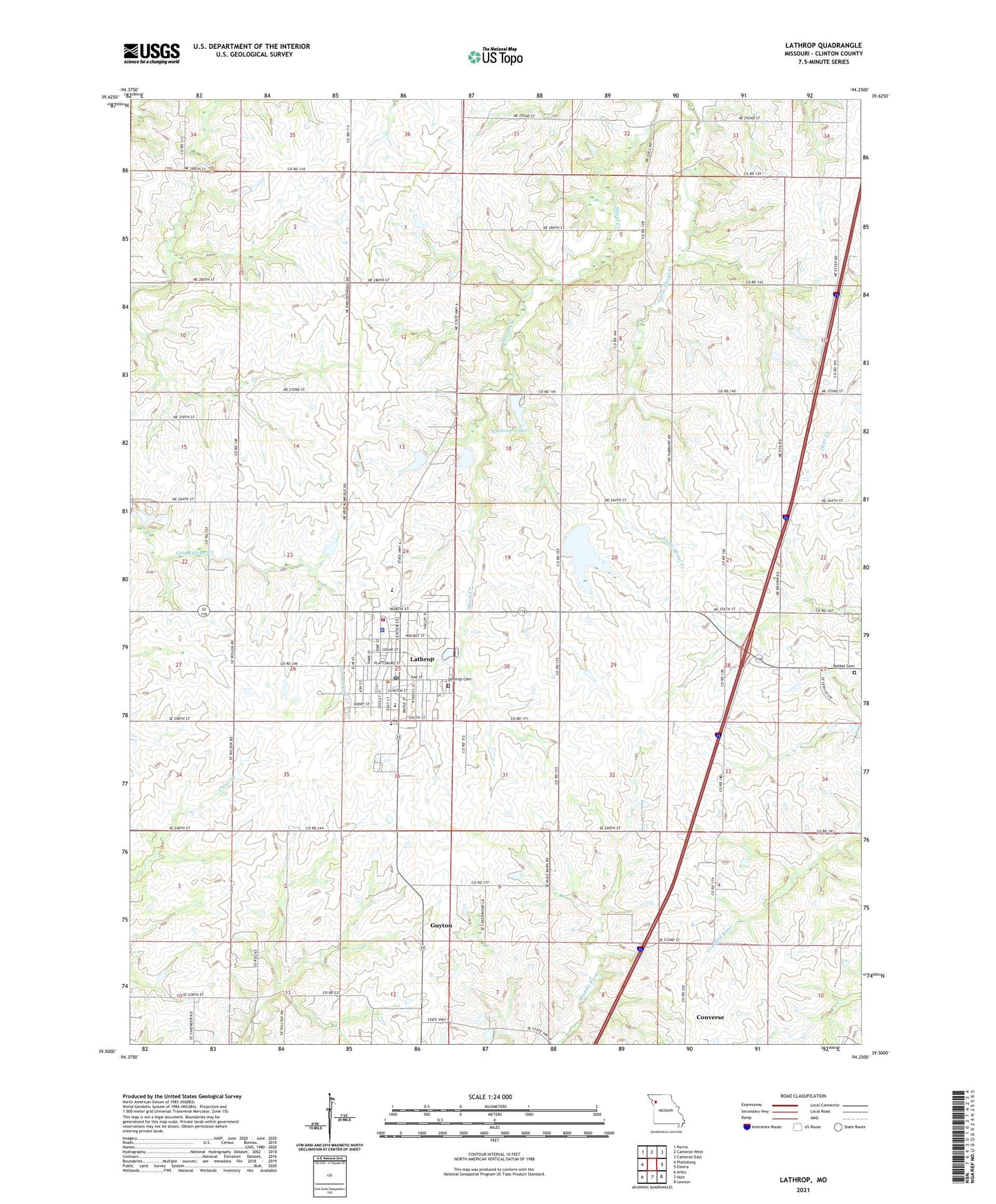
2021 topographic map quadrangle Lathrop in the state of Missouri. Scale: 1:24000. Based on the newly updated USGS 7.5' US Topo map series, this map is in the following counties: Clinton. The map contains contour data, water features, and other items you are used to seeing on USGS maps, but also has updated roads and other features. This is the next generation of topographic maps. Printed on high-quality waterproof paper with UV fade-resistant inks.
Quads adjacent to this one:
West: Plattsburg
Northwest: Perrin
North: Cameron West
Northeast: Cameron East
East: Elmira
Southeast: Lawson
South: Holt
Southwest: Arley
Contains the following named places: Bethel Cemetery, City of Lathrop, Crouch Lake East Dam, Crouch Lake West Dam, Dale School, Guyton, Lake Lenore, Lake McGinness, Lathrop, Lathrop Cemetery, Lathrop Elementary School, Lathrop Family Practice Heliport, Lathrop Fire and Rescue, Lathrop High School, Lathrop Lake, Lathrop Lake and Forest Club Dam, Lathrop Middle School, Lathrop Police Department, Lathrop Post Office, McGinness Lake Dam, Pleasant Grove School, Prairie Dell School, Prairie Hill School, Township of Lathrop, ZIP Code: 64465