MyTopo
Perrin Missouri US Topo Map
Couldn't load pickup availability
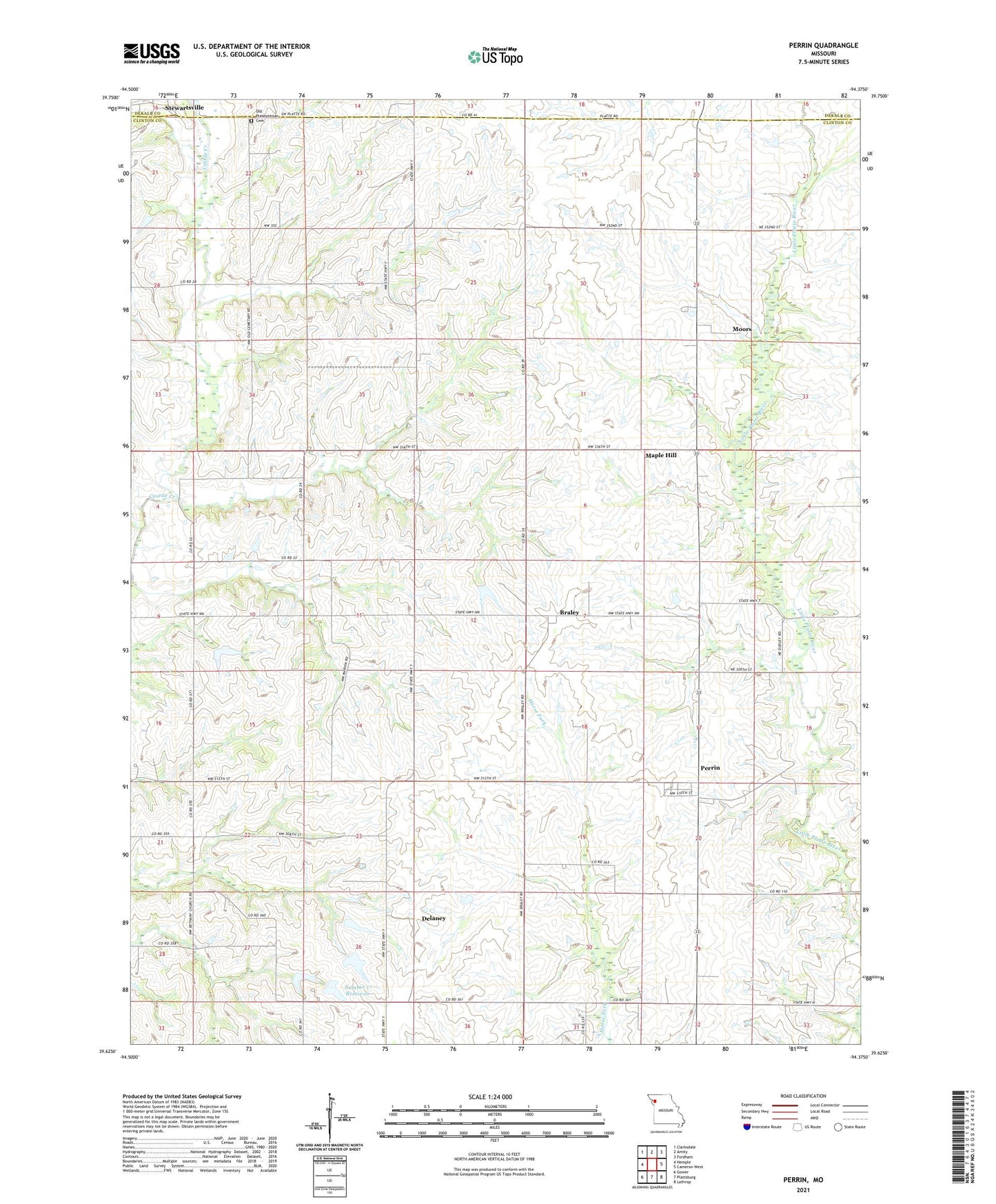
2021 topographic map quadrangle Perrin in the state of Missouri. Scale: 1:24000. Based on the newly updated USGS 7.5' US Topo map series, this map is in the following counties: Clinton, DeKalb. The map contains contour data, water features, and other items you are used to seeing on USGS maps, but also has updated roads and other features. This is the next generation of topographic maps. Printed on high-quality waterproof paper with UV fade-resistant inks.
Quads adjacent to this one:
West: Hemple
Northwest: Clarksdale
North: Amity
Northeast: Fordham
East: Cameron West
Southeast: Lathrop
South: Plattsburg
Southwest: Gower
This map covers the same area as the classic USGS quad with code o39094f4.
Contains the following named places: Bethany Church, Braley, Delaney, Eskin Post Office, Fairview School, Freeman Farm Number Three Dam, Freeman Farm Number Two Dam, Freeman Farms Dam Number One, Freemans Farm Dam Number Four, Grand Prairie School, Jones Lake Section 10 Dam, Lake Joseph Dam, Lebanon Church, Long Branch School, Maple Hill, Martin School, Marun School, Moors, Number 17 Reservoir, Old School Presbyterian Cemetery, Perrin, Perrin School, Platte Center School, Spring Hill School, Township of Platte, Victory School