MyTopo
Low Wassie Missouri US Topo Map
Couldn't load pickup availability
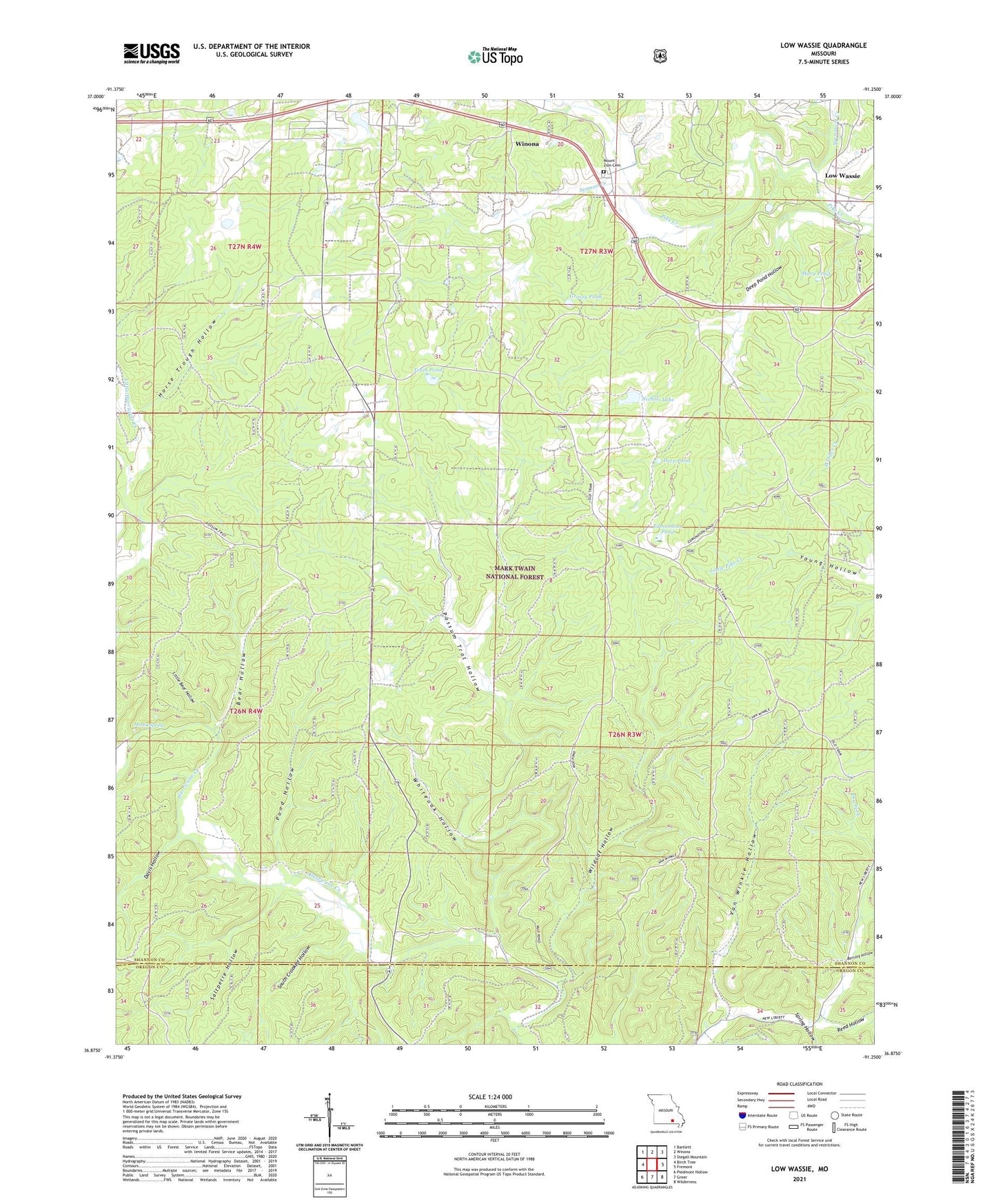
2021 topographic map quadrangle Low Wassie in the state of Missouri. Scale: 1:24000. Based on the newly updated USGS 7.5' US Topo map series, this map is in the following counties: Shannon, Oregon. The map contains contour data, water features, and other items you are used to seeing on USGS maps, but also has updated roads and other features. This is the next generation of topographic maps. Printed on high-quality waterproof paper with UV fade-resistant inks.
Quads adjacent to this one:
West: Birch Tree
Northwest: Bartlett
North: Winona
Northeast: Stegall Mountain
East: Fremont
Southeast: Wilderness
South: Greer
Southwest: Piedmont Hollow
Contains the following named places: Barnlog Hollow, Bear Hollow, Davis Hollow, Deep Pond, Deep Pond Hollow, Edmondson Pond, Folk Pond, Grassy Pond, Horse Trough Hollow, Independence School, Little Bear Hollow, Low Wassie, Marg Pond, Martin Spring, Mount Zion Cemetery, Mount Zion School, Nichols Lake, Pond Hollow, Pond Hollow School, Possum Trot Hollow, Possum Trot Lookout, Reed Hollow, Saltpetre Hollow, Seaman Creek, Shady Grove Church, South Crooked Hollow, Spring Hollow, Sunnyside School, Sycamore Creek, Tram Lookout, Tram Pond, Twinpine Picnic Area, Van Winkle Hollow, Whiteoak Hollow, Wildcat Hollow, ZIP Code: 65588