MyTopo
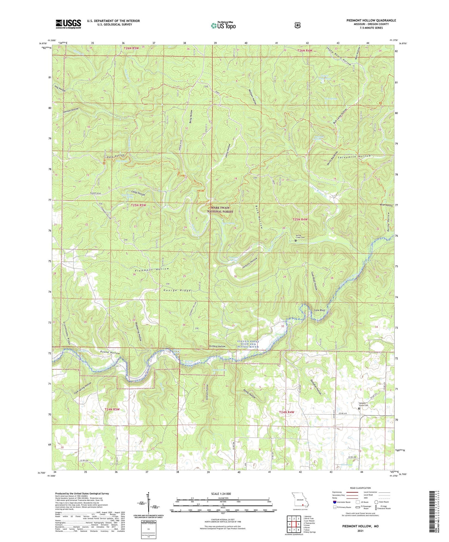
Piedmont Hollow Missouri US Topo Map
Couldn't load pickup availability
Also explore the Piedmont Hollow Forest Service Topo of this same quad for updated USFS data
2021 topographic map quadrangle Piedmont Hollow in the state of Missouri. Scale: 1:24000. Based on the newly updated USGS 7.5' US Topo map series, this map is in the following counties: Oregon. The map contains contour data, water features, and other items you are used to seeing on USGS maps, but also has updated roads and other features. This is the next generation of topographic maps. Printed on high-quality waterproof paper with UV fade-resistant inks.
Quads adjacent to this one:
West: Thomasville
Northwest: Montier
North: Birch Tree
Northeast: Low Wassie
East: Greer
Southeast: Many Springs
South: Alton
Southwest: Rover
This map covers the same area as the classic USGS quad with code o36091g4.
Contains the following named places: Bandyville, Bandyville Post Office, Becky Hollow, Bee Fork Creek, Betsy Hollow, Blowing Spring, Blubbering Hollow, Blue Ridge Trail, Blue Ridge Trail Trailhead, Bockman Spring, Bryan School, Buck Hollow, Bull Camp Hollow, Camp Hollow, Camp House Spring, Cane Bluff, Cane Bluff Access Ramp Canoe Dock, Cane Bluff Hollow, Cave Spring Hollow, Church of Christ, Cooper Spring, Cumberland Church, Denny Hollow, Denny Hollow Float Camp, Devils Backbone, Doniphan Hollow, Dry Creek, Elm Pond, George Ridge, Graham Hollow, Graham Spring, Granddaddy Ridge, Hickory Grove Cemetery, Hog Hollow, Jackson Hollow, Jenny Hollow, Johnson Hollow, Low Wassie Creek, Macedonia Church, Macedonia School, Mine Hollow, Orchard Hollow, Paty Hollow, Paty Pond, Paty Spring, Piedmont Hollow, Pine Hill School, Posy Spring, Roaring Spring, Round Hollow, Sheep Ranch Hollow, Spring Creek, Spring Creek Cemetery, Spring Creek School, Thompson Spring, Threemile Hollow, Township of Woodside, Tupelo Gum Pond, Twin Springs, Union Church, Union Ford, Well Hollow, Wolfpen Hollow