MyTopo
Monett Missouri US Topo Map
Couldn't load pickup availability
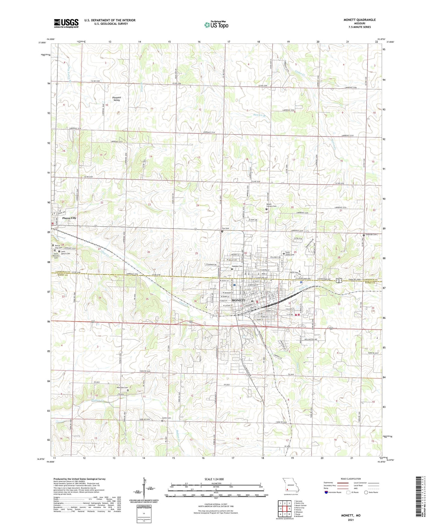
2021 topographic map quadrangle Monett in the state of Missouri. Scale: 1:24000. Based on the newly updated USGS 7.5' US Topo map series, this map is in the following counties: Lawrence, Barry. The map contains contour data, water features, and other items you are used to seeing on USGS maps, but also has updated roads and other features. This is the next generation of topographic maps. Printed on high-quality waterproof paper with UV fade-resistant inks.
Quads adjacent to this one:
West: Pierce City
Northwest: Sarcoxie
North: Stotts City
Northeast: Mount Vernon
East: Verona
Southeast: McDowell
South: Purdy
Southwest: Wheaton
This map covers the same area as the classic USGS quad with code o36093h8.
Contains the following named places: Arnold Chapel, Belleview School, Bonnieview School, Calvary Church, Carlin Cemetery, Central Elementary School, Central Park Elementary School, City of Monett, Cox Cemetery, Cox Monett Hospital, Ebenezer Church, Eventide Cemetery, Forest Park, Kelly Creek, KKBL-FM (Monett), KRMO-AM (Monett), Lee School, Liberty Church, Mc Clurg Airport, Minden School, Monett, Monett Airport, Monett City Fire Department Station 1, Monett City Police Department, Monett Elementary School, Monett Fire Department Station 2, Monett High School, Monett Intermediate School, Monett Middle School, Monett Post Office, Monett Rural Fire Department Station 1, Monett State Training School, Mount Calvary Cemetery, New Site Cemetery, New Site Church, Oakdale Cemetery, Pierce City Fire Department, Pierce City High School, Pierce City Middle School, Pleasant Dale School, Prairie View School, Saint Johns Cemetery, Saint Joseph School, Saint Mary's Cemetery, Shady Grove School, Southwest Area Career Center, Talbert School, Township of Monett, Township of Pierce, Waldensian Church, Walnut Grove School, Windmill Ridge Golf Course, ZIP Code: 65708