MyTopo
Hale Missouri US Topo Map
Couldn't load pickup availability
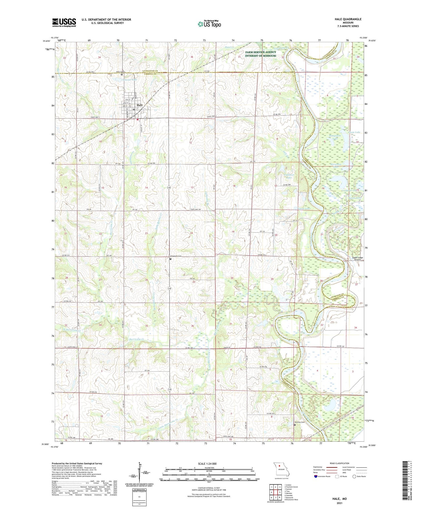
2021 topographic map quadrangle Hale in the state of Missouri. Scale: 1:24000. Based on the newly updated USGS 7.5' US Topo map series, this map is in the following counties: Carroll, Chariton, Livingston. The map contains contour data, water features, and other items you are used to seeing on USGS maps, but also has updated roads and other features. This is the next generation of topographic maps. Printed on high-quality waterproof paper with UV fade-resistant inks.
Quads adjacent to this one:
West: Tina
Northwest: Avalon
North: Fountain Grove
Northeast: Sumner
East: Mendon
Southeast: Brunswick West
South: Bosworth
Southwest: Standish
This map covers the same area as the classic USGS quad with code o39093e3.
Contains the following named places: Avwarter Dam, Ballew School, Battsville School, Button Lake, Callaway Branch, City of Hale, Clements Lake, Clements Lake Dam, Clione School, Compton School, Craddock Lake, Dean Lake, Downing Lake, Dulaney School, East Fairview School, Elizabeth Cemetery, Galbecht Lake, Galbecht Lake Dam, Goose Lake, Grassy Lake, Hale, Hale Cemetery, Hale Elementary School, Hale Fire Department, Hale High School, Hale Post Office, Hazel Hill School, Highland School, Horseshoe Lake, Hurricane Church, Hurricane Creek, Lick Creek, Lightfoot Lake, Lightfoot Lake Dam, Little Button Lake, Little Compton, Little Hurricane Creek, Lyons Lake, Lyons Lake Dam, Rampshire Lake, Sally Belcher Creek, Shull Lake, Shull Lake North Cove Dam, Shull Lake South Cove Dam, Township of Hurricane, Towstring Creek, West Hurricane Creek, Wheelbarger Lake, Winfrey Cemetery, Yellow Creek, ZIP Code: 64643